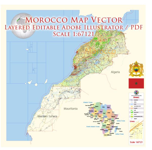
Morocco is a diverse country in North Africa known for its rich history, vibrant culture, and stunning landscapes.
Vectormap.Net provide you with the most accurate and up-to-date vector maps in Adobe Illustrator, PDF and other formats, designed for editing and printing. Please read the vector map descriptions carefully.
Here is a detailed description of some of the main cities, towns, and principal roads in Morocco:
Main Cities:
- Rabat:
- The capital city of Morocco.
- Known for its historical landmarks such as the Kasbah of the Udayas and the Hassan Tower.
- Houses government institutions and embassies.
- Casablanca:
- The largest city and an economic hub.
- Famous for the Hassan II Mosque, one of the largest mosques in the world.
- A major port city.
- Marrakech:
- A popular tourist destination known for its vibrant markets, palaces, and gardens.
- The medina, or old city, is a UNESCO World Heritage site.
- Famous for the Jemaa el-Fnaa square and the Koutoubia Mosque.
- Fes:
- Home to one of the world’s oldest universities, the University of Al Quaraouiyine.
- Known for its well-preserved medieval architecture in the old town (medina).
- Famous for the tanneries and the Bou Inania Madrasa.
- Tangier:
- A port city with a strategic location at the Strait of Gibraltar.
- Known for its unique blend of European and African influences.
- Famous for the Kasbah Museum and the Caves of Hercules.
- Agadir:
- A modern coastal city known for its beaches and resorts.
- The city was rebuilt after a devastating earthquake in 1960.
- Offers a more relaxed atmosphere compared to other Moroccan cities.
Towns:
- Chefchaouen:
- Famous for its blue-painted streets and buildings.
- Nestled in the Rif Mountains, known for its scenic beauty.
- Essaouira:
- A coastal town with a well-preserved medina.
- Known for its historic ramparts, beaches, and vibrant arts scene.
- Ouarzazate:
- Known as the “Gateway to the Sahara” and the “Hollywood of Morocco.”
- A popular filming location for many movies and TV series.
- Gateway to the Draa Valley and the desert.
Principal Roads:
- N1 (National Route 1):
- Connects Tangier in the north to the border with Western Sahara in the south.
- Passes through major cities like Rabat, Casablanca, and Marrakech.
- N9:
- Connects Marrakech to Ouarzazate, passing through the High Atlas Mountains.
- Offers stunning views and is a popular route for tourists.
- N13:
- Connects Fes to Oujda in the northeast, near the border with Algeria.
- N6:
- Connects Rabat to Meknes and then continues to Fes.
- A3 (Autoroute Casablanca–Marrakech):
- A modern toll highway connecting the economic hub of Casablanca to the tourist destination Marrakech.
These descriptions provide a snapshot of the diverse regions and attractions found in Morocco, but the country offers much more to explore and discover. Keep in mind that road conditions and infrastructure may vary, so it’s advisable to check for updates and travel advisories before planning a trip.


 Author: Kirill Shrayber, Ph.D. FRGS