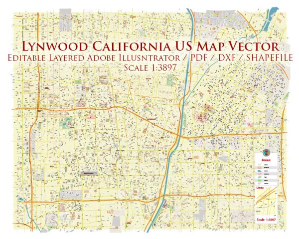
A general overview of Lynwood, California, including its districts, communities, and street system.
Vectormap.Net provide you with the most accurate and up-to-date vector maps in Adobe Illustrator, PDF and other formats, designed for editing and printing. Please read the vector map descriptions carefully.
Lynwood is a city located in Los Angeles County, California, United States. It is situated in the southern part of the Los Angeles metropolitan area.
Here is a general description of Lynwood:
- Districts and Communities:
- Lynwood does not have officially designated districts, but it consists of various neighborhoods and communities.
- Some of the neighborhoods in Lynwood include Lynwood Gardens, Lynwood Park, Plaza de Mexico, and others.
- The city is known for its diverse population and community-oriented atmosphere.
- Street System:
- Lynwood follows the typical street grid system common in many cities in the United States.
- Major thoroughfares and streets in Lynwood include Long Beach Boulevard, Atlantic Avenue, and Imperial Highway.
- The city’s street layout is organized in a grid pattern, with numbered streets running north-south and named avenues running east-west.
- The street numbering convention often starts from major thoroughfares or central points within the city.
- Landmarks and Facilities:
- Lynwood has various landmarks, parks, and community facilities that contribute to the city’s character.
- Parks like Lynwood City Park and South Gate Park provide recreational spaces for residents.
- Educational institutions, including Lynwood Unified School District schools, are an integral part of the community.
- Transportation:
- Lynwood is well-connected by major highways, making it accessible to surrounding areas. Interstate 105 (I-105) and Interstate 710 (I-710) are among the major highways nearby.
- Public transportation options, such as buses, may be available for residents to navigate within Lynwood and travel to adjacent cities.
- Demographics and Culture:
- Lynwood has a diverse population, reflecting the multicultural nature of Southern California.
- The city may host cultural events, community festivals, and other activities that celebrate its residents’ backgrounds and interests.
For the most accurate and up-to-date information, consider checking with local government sources, community organizations, or recent online resources that provide details about Lynwood’s districts, communities, and street systems.


 Author: Kirill Shrayber, Ph.D. FRGS