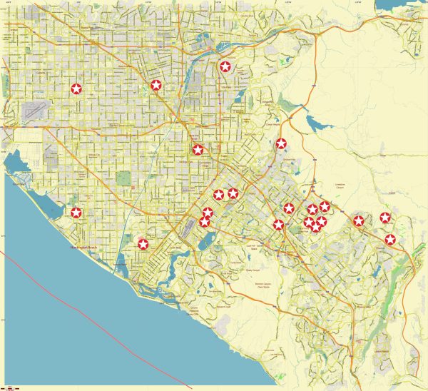
Some about the current district, community, and street systems in South-East Los Angeles, including Orange County, a general overview based on information available up to that point.
Please note that the landscape of neighborhoods and communities can change over time due to urban development, revitalization projects, and other factors.
Vectormap.Net provide you with the most accurate and up-to-date vector maps in Adobe Illustrator, PDF and other formats, designed for editing and printing. Please read the vector map descriptions carefully.
- Orange County: Orange County is located in Southern California and is known for its affluent communities, beautiful coastline, and diverse population. Major cities in Orange County include Anaheim, Irvine, Santa Ana, and Huntington Beach. Each city has its own unique neighborhoods and districts.
- South-East Los Angeles: The term “South-East Los Angeles” can be somewhat ambiguous, as it may refer to the southeastern part of the city of Los Angeles itself or neighboring areas in Los Angeles County. In this context, it’s important to distinguish between Los Angeles city and the surrounding county.
- Los Angeles City: The southeastern part of Los Angeles includes neighborhoods like South Los Angeles, Watts, and South Gate. Each of these areas has its own character and history. South Los Angeles, for example, is known for its cultural diversity, while Watts has historical significance related to the Watts Riots in 1965.
- Los Angeles County: In Los Angeles County, you may find cities such as Downey, Norwalk, and Paramount, which are located in the southeastern part of the county. These cities have their own distinct neighborhoods and communities.
- Street System: The street system in Orange County and South-East Los Angeles is generally laid out in a grid pattern, with major thoroughfares and highways connecting various communities. Notable highways in the area include the I-5, I-405, and I-605, providing essential transportation links.
Local streets and avenues will vary depending on the specific city or community you are in. Cities often have a mix of residential, commercial, and industrial zones, with streets catering to different purposes.
Orange County, California, is well-connected with a network of highways and major roads. Some of the principal roads in Orange County include:
- Interstate 5 (I-5): A major north-south freeway that runs through the western part of Orange County, connecting it to Los Angeles and San Diego.
- State Route 55 (SR-55): Also known as the Costa Mesa Freeway, it runs north-south through central Orange County, connecting the cities of Anaheim, Orange, and Costa Mesa.
- State Route 22 (SR-22): The Garden Grove Freeway, which runs east-west, connecting Long Beach to Orange and Santa Ana.
- State Route 91 (SR-91): The Riverside Freeway, an east-west freeway that connects Orange County to the Inland Empire and Riverside County.
- Interstate 405 (I-405): A major north-south freeway that runs through the western part of Orange County, connecting cities like Irvine, Costa Mesa, and Huntington Beach.
- State Route 57 (SR-57): A north-south freeway that connects Orange County to the Inland Empire, running through cities like Anaheim and Fullerton.
- State Route 73 (SR-73): A toll road that runs through the eastern part of Orange County, connecting cities like Irvine and Newport Beach.
- State Route 133 (SR-133): Also known as the Laguna Freeway, it runs north-south, connecting Irvine to the cities of Laguna Beach and Laguna Niguel.
- State Route 241 (SR-241): A toll road that runs through eastern Orange County, connecting the cities of Rancho Santa Margarita and Yorba Linda.
For the most accurate and current information about districts, communities, and streets, it is recommended to check with local government sources, city planning departments, or community organizations in the specific areas you are interested in. Keep in mind that urban development and changes can alter the landscape over time.


 Author: Kirill Shrayber, Ph.D. FRGS