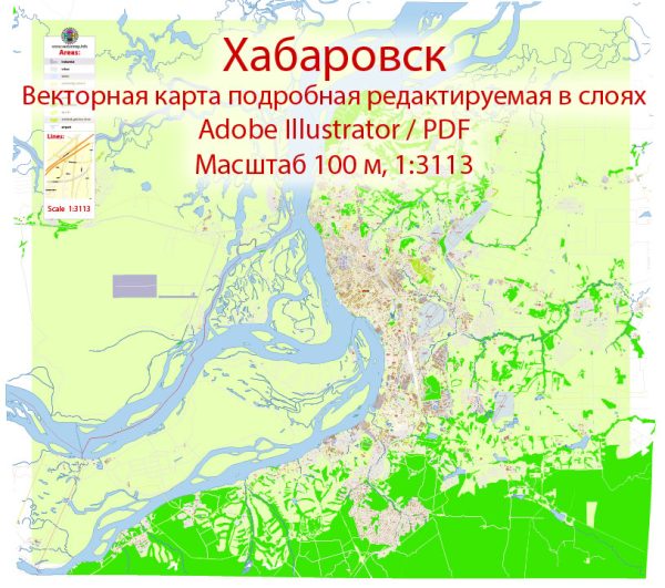
A general overview of the economic and transport connections in Khabarovsk, Russia.
Vectormap.Net provide you with the most accurate and up-to-date vector maps in Adobe Illustrator, PDF and other formats, designed for editing and printing. Please read the vector map descriptions carefully.
Economic Overview:
1. Industries:
- Natural Resources: Khabarovsk, located in the Russian Far East, is known for its abundant natural resources. The region is rich in timber, minerals, and has significant hydroelectric potential.
- Fishing and Seafood Industry: The proximity to the Amur River and the Sea of Japan supports a thriving fishing industry, contributing to the regional economy.
- Manufacturing: There are manufacturing industries, including the production of machinery, chemicals, and food processing.
2. Trade:
- International Trade: Khabarovsk serves as a gateway to Russia’s trade with the Asia-Pacific region. It has important trade ties with countries like China, Japan, and South Korea.
- Export and Import: The region exports natural resources, timber, and seafood, while importing manufactured goods and machinery.
3. Infrastructure:
- Transportation Infrastructure: Khabarovsk has a well-developed transportation infrastructure, including roads, railways, and air transport.
- Ports: The region has seaports along the Sea of Japan, facilitating maritime trade.
Transport Connections:
1. Air Transport:
- Khabarovsk International Airport: The city is served by Khabarovsk International Airport (KHV), providing domestic and international flights. It connects the region to major cities in Russia and the Asia-Pacific region.
2. Rail Transport:
- Trans-Siberian Railway: Khabarovsk is a key stop on the Trans-Siberian Railway, which is a crucial transportation route connecting Moscow to the Russian Far East and beyond. This rail link plays a vital role in the transportation of goods and passengers.
3. Road Network:
- Highways: The city is connected to the Russian road network, facilitating ground transportation. The Trans-Siberian Highway is a major route passing through the region.
- Bridges: The city has several bridges over the Amur River, enhancing connectivity.
4. River Transport:
- Amur River: The Amur River is a significant waterway in the region, and river transport plays a role in cargo movement.
5. Economic Zones:
- Special Economic Zones (SEZs): Russia has established special economic zones in the Far East, offering economic incentives to attract investment and stimulate economic activities. Khabarovsk may benefit from these zones.
Recent Developments:
Since my last update was in January 2022, there might have been new developments or changes in economic and transport infrastructure in Khabarovsk. It is advisable to check the latest sources or local news for the most current information.


 Author: Kirill Shrayber, Ph.D. FRGS