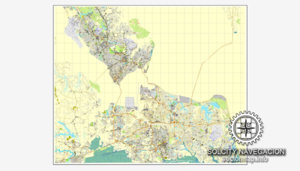
Hampton Roads, Virginia, is a metropolitan area in the southeastern part of the state. It includes several cities and communities, with Norfolk, Virginia Beach, Chesapeake, Newport News, Hampton, Portsmouth, Suffolk, and others.
Vectormap.Net provide you with the most accurate and up-to-date vector maps in Adobe Illustrator, PDF and other formats, designed for editing and printing. Please read the vector map descriptions carefully.
Main Coordinates (Approximate):
- Latitude: 36.8508° N
- Longitude: 76.2859° W
Total Area: The total area of Hampton Roads is around 4,608 square miles (11,930 square kilometers).
Main Streets and Roads: Hampton Roads is characterized by a network of highways, bridges, and tunnels that connect the various cities and communities. Some of the main roads and routes in the region include:
- Interstate 64 (I-64): A major east-west interstate highway that connects the Hampton Roads area with Richmond and extends further west.
- Interstate 264 (I-264): This interstate highway connects the cities of Norfolk and Virginia Beach, providing a route to the oceanfront.
- Interstate 664 (I-664): Connecting the cities of Hampton and Newport News to Suffolk and Chesapeake, I-664 includes the Monitor-Merrimac Memorial Bridge-Tunnel.
- Route 17: A significant north-south highway that runs through the region, connecting various cities and communities.
- Route 58: An east-west highway that provides a connection between Suffolk and Virginia Beach.
Railroads:
Railroads play a crucial role in the transportation infrastructure of Hampton Roads. Several major rail lines and networks serve the area, facilitating the movement of goods and passengers. The railroads in Hampton Roads are important for various industries, including shipping, manufacturing, and logistics.
Some of the key features and aspects of railroads in Hampton Roads include:
- Port Connectivity: Hampton Roads is home to one of the largest natural harbors on the East Coast. Railroads connect the port facilities to inland distribution points, facilitating the efficient movement of goods between ships and various destinations.
- Military Presence: The region has a significant military presence, including naval bases and installations. Rail transportation is vital for the movement of military personnel, equipment, and supplies.
- Intermodal Facilities: Hampton Roads has intermodal facilities that allow for the seamless transfer of cargo between different modes of transportation, such as rail, truck, and ship. These facilities enhance the region’s overall transportation efficiency.
- Freight Transportation: Railroads in Hampton Roads play a crucial role in transporting freight, including bulk commodities, manufactured goods, and raw materials. This helps support the economic activities of the region.
- Passenger Rail Service: In addition to freight transportation, there are passenger rail services connecting Hampton Roads to other parts of Virginia and beyond. Amtrak and other commuter rail services provide options for travelers.
It’s essential to note that developments in transportation infrastructure can change over time. For the latest and most accurate information on the railroads in Hampton Roads, it is recommended to check with local transportation authorities, railway companies, or relevant government agencies for updates and recent developments.


 Author: Kirill Shrayber, Ph.D. FRGS