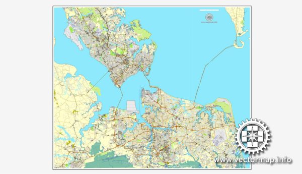
A general overview of the economic and transportation aspects of the Hampton Roads region, including Norfolk and Newport News in Virginia, United States.
Vectormap.Net provide you with the most accurate and up-to-date vector maps in Adobe Illustrator, PDF and other formats, designed for editing and printing. Please read the vector map descriptions carefully.
Economic Overview:
Diverse Economy:
The Hampton Roads region has a diverse economy with key sectors including:
- Military and Defense: The presence of several military installations, including Naval Station Norfolk, contributes significantly to the region’s economy.
- Port and Shipping: The Port of Virginia, with major facilities in Norfolk and Newport News, is a major economic driver, handling a substantial portion of the East Coast’s container traffic.
- Tourism: The area attracts tourists with its historical sites, cultural attractions, and waterfront areas. Norfolk, in particular, has a vibrant arts and cultural scene.
- Healthcare and Research: The region hosts major healthcare institutions and research centers, contributing to the healthcare and biotechnology sectors.
- Higher Education: Norfolk and Newport News have educational institutions like Old Dominion University and Christopher Newport University, fostering education and research.
Challenges and Opportunities:
While the region has economic strengths, it also faces challenges, such as potential impacts from federal budget decisions affecting military spending and competition with other East Coast ports. Continued investment in diversification and infrastructure is crucial for sustained economic growth.
Transportation Overview:
Port of Virginia:
The Port of Virginia, including terminals in Norfolk and Newport News, is one of the largest and busiest ports on the East Coast. It serves as a gateway for international trade, handling containerized cargo, bulk cargo, and more. Investments and expansions in port infrastructure aim to enhance its competitiveness.
Rail and Road Networks:
The region is well-connected by road and rail. Interstates 64 and 264 provide essential transportation corridors, facilitating the movement of goods and people. Norfolk Southern and CSX operate major rail lines, supporting freight transportation.
Airports:
Norfolk International Airport (ORF) serves as a key regional airport, providing domestic and international flights. It plays a vital role in supporting business and tourism.
Public Transportation:
Public transportation is managed by Hampton Roads Transit (HRT), which operates buses, ferries, and light rail services. The Tide, a light rail system in Norfolk, enhances public transit options.
Recent Developments (as of 2022):
- Infrastructure Investments: Ongoing and planned infrastructure projects aim to enhance transportation networks and support economic growth. This includes port expansions, road improvements, and public transit upgrades.
- Economic Diversification: Efforts are underway to diversify the economy beyond traditional sectors, promoting innovation, technology, and entrepreneurship.
- Military Presence: The strong military presence remains a key aspect of the region’s economy, with associated contracts and defense-related activities.
Please check more recent sources for the latest updates and developments in the economic and transportation landscape of the Hampton Roads region, Norfolk, and Newport News.


 Author: Kirill Shrayber, Ph.D. FRGS