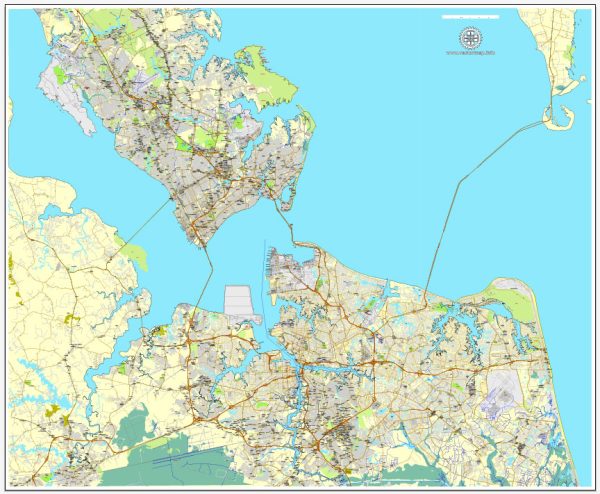
Some specific details about toll roads in Hampton, Newport News, Norfolk, Chesapeake, Portsmouth, and Virginia Beach, and some general information about toll roads in Virginia and the Hampton Roads region based on historical information.
Vectormap.Net provide you with the most accurate and up-to-date vector maps in Adobe Illustrator, PDF and other formats, designed for editing and printing. Please read the vector map descriptions carefully.
- Hampton Roads Bridge-Tunnel (HRBT):
- The HRBT is a major transportation artery connecting Hampton and Newport News with Norfolk and Virginia Beach.
- As of my last update, there were no tolls for using HRBT, but plans for future improvements might involve tolls or other funding mechanisms.
- Chesapeake Expressway:
- The Chesapeake Expressway is a tolled road that connects the city of Chesapeake with the city of Virginia Beach.
- Toll rates can vary, and it’s advisable to check with the local transportation authority or the official website for the most up-to-date information.
- Downtown and Midtown Tunnels:
- These tunnels connect Norfolk and Portsmouth and were traditionally tolled.
- Tolling for these tunnels is managed by the Elizabeth River Tunnels (ERT) project. Toll rates may vary, and there might be different rates for residents and non-residents.
- Jordan Bridge:
- The Jordan Bridge connects Chesapeake and Portsmouth.
- This tolled bridge is operated by Elizabeth River Crossings, and toll rates can vary.
- Highway 44 (I-44):
- Part of I-44 runs through Virginia Beach.
- While I-44 itself may not have tolls, it’s essential to be aware of any changes in tolling policies or new projects.
Please note that changes to tolling and road systems can occur, and it’s advisable to check with local transportation authorities or visit official websites for the most current information. Toll rates, payment methods, and policies can be subject to change, and staying informed will help ensure accurate and up-to-date details.


 Author: Kirill Shrayber, Ph.D. FRGS