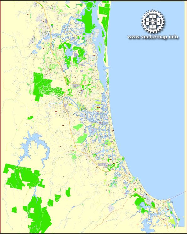
A general overview of the roads and streets infrastructure in the Gold Coast, Australia.
Vectormap.Net provide you with the most accurate and up-to-date vector maps in Adobe Illustrator, PDF and other formats, designed for editing and printing. Please read the vector map descriptions carefully.
The Gold Coast, located in the southeastern corner of the state of Queensland, is known for its beautiful beaches, tourism, and vibrant urban environment. The road network plays a crucial role in connecting various suburbs, commercial areas, and recreational spaces. Here are some key features of the roads and streets infrastructure:
- Pacific Motorway (M1): The M1 is the major highway connecting the Gold Coast to Brisbane, the capital of Queensland. It is a vital transport corridor, facilitating the movement of people and goods between these two major urban centers.
- Gold Coast Highway: This coastal road runs parallel to the shoreline and connects various suburbs along the coast, including Surfers Paradise, Broadbeach, Miami, and Burleigh Heads. It is a key route for both locals and tourists, providing access to beaches, shopping districts, and entertainment areas.
- Smith Street Motorway: Linking the northern and southern parts of the Gold Coast, the Smith Street Motorway is an important route that passes through Southport, a central business district. It connects with the Pacific Motorway and provides access to residential and commercial areas.
- Nerang-Broadbeach Road: This road connects the suburb of Nerang to Broadbeach and is significant for local traffic, providing access to residential neighborhoods, schools, and shopping centers.
- Helensvale Road: Serving the northern part of the Gold Coast, Helensvale Road connects the Pacific Motorway with Helensvale and other nearby suburbs. It is an essential route for commuters and residents in the northern region.
- Reedy Creek Road: Located inland, Reedy Creek Road is a key arterial road connecting suburbs like Burleigh Waters, Varsity Lakes, and Reedy Creek. It provides access to residential areas, schools, and parks.
- Robina Parkway: Serving the planned community of Robina, the Robina Parkway connects Robina to the Pacific Motorway and other nearby areas. Robina is a major commercial and residential hub on the Gold Coast.
- Local Streets: The Gold Coast has an extensive network of local streets that connect neighborhoods, schools, parks, and commercial areas. These streets form the backbone of the local transportation system, facilitating daily commuting and providing access to community facilities.
The Gold Coast is continually evolving, and infrastructure projects may be underway to improve road networks, alleviate congestion, and accommodate the region’s growing population. For the latest and most detailed information, it’s advisable to check with local authorities or official transportation departments.


 Author: Kirill Shrayber, Ph.D.