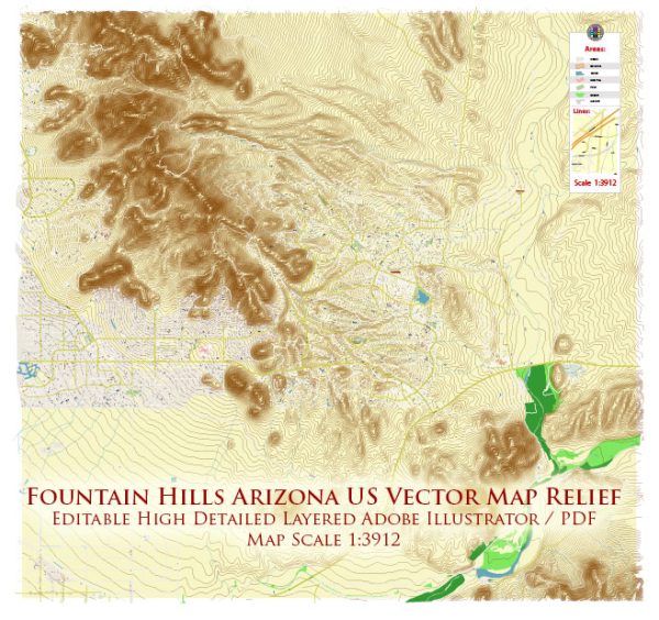
Some information about the industrial history and road system of Fountain Hills, Arizona. A general overview based on historical patterns and typical characteristics of similar areas.
Vectormap.Net provide you with the most accurate and up-to-date vector maps in Adobe Illustrator, PDF and other formats, designed for editing and printing. Please read the vector map descriptions carefully.
Industrial History: Fountain Hills, Arizona, is primarily known as a residential community with a focus on natural beauty and outdoor recreation rather than a major industrial center. Historically, the region has been characterized by its desert landscape and proximity to the McDowell Mountains. The town was incorporated in 1989 and has a relatively short history compared to other areas in the state.
While Fountain Hills may not have a significant industrial history, it has likely experienced growth and development in response to the broader economic trends in Arizona. Industries such as real estate, tourism, and service-oriented businesses are often prevalent in communities like Fountain Hills, given the area’s appeal as a residential destination.
Road System: Fountain Hills is well-connected by a network of roads that facilitate transportation within the town and connect it to neighboring communities. The road system is essential for residents, businesses, and visitors to navigate the area efficiently. Key roads in Fountain Hills may include:
- Shea Boulevard: A major east-west road that traverses Fountain Hills and connects it to other parts of the Phoenix metropolitan area.
- Saguaro Boulevard: This road runs north-south and is another important route within Fountain Hills, providing access to various neighborhoods and amenities.
- Palisades Boulevard: Serving as a main artery, Palisades Boulevard contributes to the local road network, offering connectivity to residential areas and local services.
- Highway 87 (Beeline Highway): This highway connects Fountain Hills to other parts of Arizona, including the larger Phoenix area. It plays a crucial role in regional transportation.
The road system in Fountain Hills is likely designed to complement the town’s layout, providing easy access to parks, shopping centers, schools, and other community facilities. Additionally, the road network contributes to the overall accessibility and appeal of Fountain Hills for both residents and visitors.
For the most up-to-date and detailed information on Fountain Hills’ industrial history and road system, I recommend checking with local historical societies, town archives, or municipal government sources. They may have specific records and data related to the area’s development and infrastructure.


 Author: Kirill Shrayber, Ph.D. FRGS