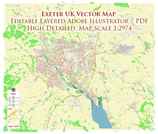
Exeter is a historic city located in Devon, South West England. Its history dates back to Roman times, and it has played a significant role in the region’s development. The transportation infrastructure of Exeter has evolved over the centuries to accommodate its growing population and economic activities.
Vectormap.Net provide you with the most accurate and up-to-date vector maps in Adobe Illustrator, PDF and other formats, designed for editing and printing. Please read the vector map descriptions carefully.
Historical Overview:
- Roman Period (1st Century AD): Exeter, known as Isca Dumnoniorum during Roman times, was a significant Roman settlement. The Romans established a fortress and a thriving civilian settlement. The city’s location along the River Exe made it strategically important for trade and military purposes.
- Medieval Period (11th-15th Century): Exeter continued to grow in the medieval period, becoming a prosperous market town. The construction of the Exeter Cathedral started in 1114, and it remains a prominent landmark today. The city became a center for woolen cloth production and trade.
- Tudor and Stuart Periods (16th-17th Century): Exeter faced challenges during the Tudor and Stuart periods, including the plague and the Civil War. The city’s defensive walls were built during this time to protect against potential threats.
- 18th and 19th Centuries: The Industrial Revolution had a significant impact on Exeter’s economy, leading to the development of industries such as papermaking and the production of agricultural machinery. The construction of the Exeter Canal in the late 16th century improved connectivity for trade.
Transportation Infrastructure:
- Roads: The road network in Exeter has evolved over the centuries. The city is well-connected by major roads, including the M5 motorway, providing links to Bristol and Birmingham to the north and Plymouth and Cornwall to the south.
- Railways: Exeter’s railway history dates back to 1844 when the first railway line connected Exeter to London. The railway station, Exeter St Davids, is a major transportation hub with connections to various destinations across the country.
- Exeter International Airport: The airport, located about 6 miles east of the city center, connects Exeter to several domestic and international destinations. It plays a crucial role in facilitating air travel for the region.
- Public Transportation: Exeter has a well-established bus network operated by several companies, providing convenient transportation within the city and its surrounding areas.
- Cycling and Walking: In recent years, there has been a focus on promoting sustainable transportation. Exeter has developed cycling lanes and walking paths to encourage environmentally friendly modes of commuting.
- Waterways: While not as prominent today, the Exeter Canal played a crucial role in the city’s history. It was constructed in the late 16th century and was used for the transportation of goods.
Exeter’s transportation infrastructure continues to adapt to modern needs, supporting its role as a regional center for commerce, education, and culture. The city’s rich history is reflected in its architecture, landmarks, and the layout of its streets.


 Author: Kirill Shrayber, Ph.D.