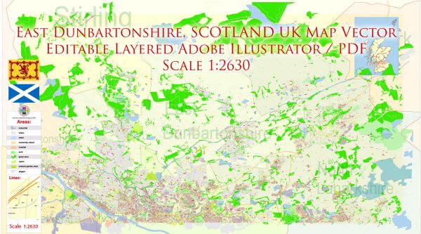
East Dunbartonshire is a council area located in the Central Belt of Scotland, United Kingdom. East Dunbartonshire, a general overview of the development of roads in Scotland, which would include the region.
Vectormap.Net provide you with the most accurate and up-to-date vector maps in Adobe Illustrator, PDF and other formats, designed for editing and printing. Please read the vector map descriptions carefully.
- Early Roads: The road system in Scotland has ancient origins. In the medieval period, many of the routes were developed for trade and communication, connecting towns and villages. These early roads were often simple dirt tracks.
- Turnpike Trusts: During the 18th and early 19th centuries, the turnpike system was introduced. Turnpike trusts were established to collect tolls for maintaining and improving roads. This led to the construction of more durable and well-maintained roads, facilitating easier transportation of goods and people.
- Victorian Era: The Victorian era saw significant advancements in road infrastructure. Engineers like Thomas Telford and John McAdam played crucial roles in road development. Telford, in particular, designed and built many roads and bridges, including some in Scotland.
- 20th Century: The 20th century brought further improvements to the road network. The rise of automobiles prompted the construction of more extensive and modern roads. The A roads and motorways that connect various regions were developed during this period.
- Recent Developments: In more recent times, efforts have been made to upgrade and expand the road network to accommodate increasing traffic and population growth. Investments in road safety, maintenance, and the integration of modern technologies have been ongoing.
- East Dunbartonshire: East Dunbartonshire, being a part of the wider Scottish road network, has benefited from these historical developments. Key roads and motorways, such as the M80 and A80, traverse the area, connecting it to neighboring regions. Local roads have been developed to support urban and rural connectivity.
- Challenges and Future Plans: Challenges such as congestion and environmental concerns have led to ongoing discussions about sustainable transportation and infrastructure planning. Authorities continue to work on solutions that balance the need for efficient transportation with environmental and community considerations.
It’s important to note that specific details about East Dunbartonshire’s road system would require more localized historical records and documentation. Local archives, historical societies, and government records can provide more detailed insights into the development of roads in the region.


 Author: Kirill Shrayber, Ph.D.