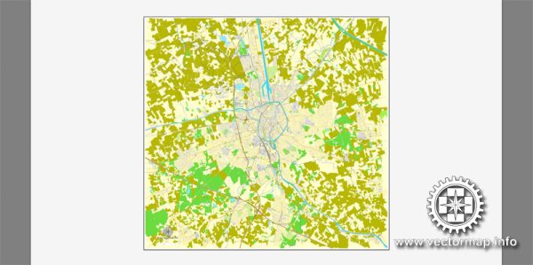
A general overview of the economic and transportation aspects of Bruges, Belgium.
Vectormap.Net provide you with the most accurate and up-to-date vector maps in Adobe Illustrator, PDF and other formats, designed for editing and printing. Please read the vector map descriptions carefully.
Economic Overview:
1. Economy:
- Bruges, located in the northwest of Belgium, is part of the Flanders region, which is known for its diverse and developed economy.
- The city has a strong focus on tourism, given its well-preserved medieval architecture and canals, making it a popular destination for visitors.
2. Tourism:
- Tourism plays a significant role in Bruges’ economy. The city attracts millions of tourists annually, contributing to the local economy through hospitality, restaurants, guided tours, and various cultural activities.
- The historic center of Bruges is a UNESCO World Heritage Site, adding to its appeal for tourists.
3. Other Sectors:
- In addition to tourism, Bruges has a diverse economy, with sectors such as manufacturing, services, and retail playing important roles.
- The region is known for its chocolate and beer production, contributing to the local economy.
Transportation Overview:
1. Roads:
- Bruges is well-connected by road, with a network of highways linking it to other major cities in Belgium and neighboring countries.
- The city has an efficient road infrastructure, making it accessible for both local residents and tourists.
2. Rail:
- The Bruges railway station serves as a key transportation hub, connecting the city to major Belgian cities like Brussels, Ghent, and Antwerp.
- The railway system provides convenient options for both domestic and international travel.
3. Waterways:
- Bruges is known for its canals, and while they are primarily a tourist attraction, they historically played a crucial role in the transportation of goods.
- The Zeebrugge port, located nearby, is one of the largest and busiest ports in Belgium. It handles a significant amount of cargo and serves as a vital gateway to international trade.
4. Air:
- The nearest major airport to Bruges is Brussels Airport (Zaventem), which is approximately 100 kilometers away. This airport provides international and domestic flights, connecting Bruges to global destinations.
5. Local Transport:
- Within the city, transportation is facilitated by buses and bicycles. Biking is a popular mode of transport for both locals and tourists to explore the city’s charming streets and attractions.


 Author: Kirill Shrayber, Ph.D. FRGS