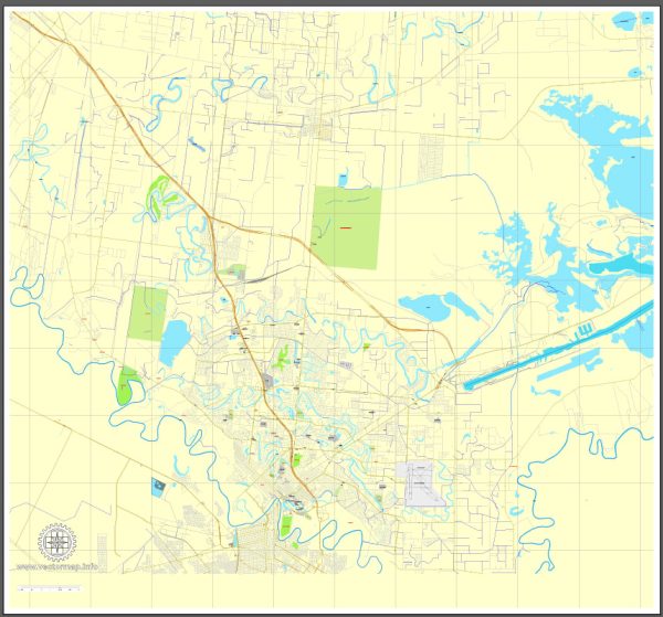
A general overview of the economic and transportation aspects of Brownsville, Texas.
Vectormap.Net provide you with the most accurate and up-to-date vector maps in Adobe Illustrator, PDF and other formats, designed for editing and printing. Please read the vector map descriptions carefully.
Economic Overview:
- Diverse Economy: Brownsville has a diverse economy with key sectors including trade, healthcare, education, and manufacturing. Its proximity to the U.S.-Mexico border contributes to its role as a hub for cross-border trade.
- Maquiladora Industry: The city benefits from the maquiladora industry, with numerous manufacturing plants operating in the region. These plants often assemble products for export to the United States.
- Port of Brownsville: The Port of Brownsville is a major economic driver. It is one of the leading deepwater ports on the U.S.-Mexico border, handling a variety of cargo, including steel, grain, and petroleum products. The port also plays a significant role in trade with Mexico.
- Healthcare and Education: The healthcare and education sectors are prominent in Brownsville. The University of Texas Rio Grande Valley has a campus in the city, contributing to education and research activities.
- Tourism: Brownsville attracts tourists with its historical sites, cultural events, and outdoor activities. The city’s historic downtown, Gladys Porter Zoo, and the Palo Alto Battlefield National Historical Park are among the attractions.
Transportation Overview:
- Highways: Brownsville is well-connected by highways. Interstate 69E and U.S. Highways 77 and 83 provide essential north-south routes, while State Highway 4 connects the city to the Port of Brownsville.
- Brownsville South Padre Island International Airport: The city is served by the Brownsville South Padre Island International Airport, providing domestic flights.
- Port of Brownsville: As mentioned earlier, the Port of Brownsville is a vital transportation hub, facilitating maritime trade and commerce. It is a deepwater port capable of handling a wide range of vessels.
- Rail Services: Brownsville is connected to the national rail network, providing efficient rail transportation for goods.
- Public Transportation: The city has a public transportation system, including buses, to serve the local community’s commuting needs.
It’s recommended to check more recent sources for the latest developments in Brownsville’s economy and transportation infrastructure. Local government websites, business reports, and news outlets are good resources for updated information.


 Author: Kirill Shrayber, Ph.D. FRGS