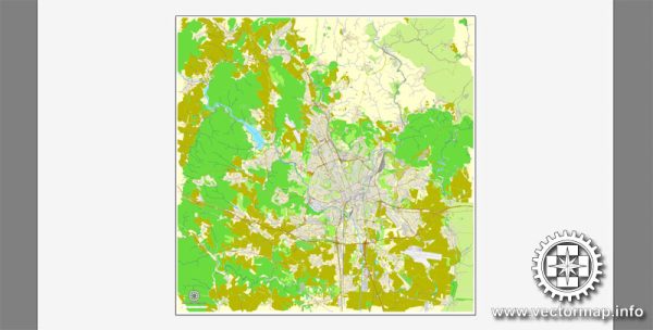
A general overview of the economic and transportation aspects of Brno, Czech Republic.
Vectormap.Net provide you with the most accurate and up-to-date vector maps in Adobe Illustrator, PDF and other formats, designed for editing and printing. Please read the vector map descriptions carefully.
Economic Overview: Brno is the second-largest city in the Czech Republic and serves as the capital of the South Moravian Region. The city has a diverse and robust economy, contributing significantly to the overall economic development of the country. The economic activities in Brno are spread across various sectors, including manufacturing, services, technology, and education.
- Manufacturing and Industry: Brno has a long history of industrial development. It is known for its manufacturing sector, which includes machinery, automotive components, and electronics. Several international companies have established their presence in Brno, contributing to the city’s economic growth.
- Technology and Innovation: Brno has emerged as a hub for technology and innovation. The city hosts several research institutions, universities, and technology parks, fostering a thriving IT and research community. The presence of tech companies and startups has contributed to the city’s reputation as a technology center.
- Services and Commerce: The service sector is also a significant contributor to Brno’s economy. The city has a well-developed commercial infrastructure with shopping centers, restaurants, and a vibrant cultural scene. The tourism industry is also growing, attracting visitors to explore Brno’s historical and cultural attractions.
Transportation: Brno has a well-connected transportation network that facilitates local and international travel. Here are key aspects of transportation in Brno:
- Public Transport: Brno has an extensive public transportation system, including buses and trams, operated by the Brno Public Transport Company (DPMB). The network covers the city and its suburbs, making it convenient for residents and visitors to move around.
- Rail Transportation: Brno is a major railway hub with connections to various national and international destinations. The main railway station, Brno Main Station (Brno hlavní nádraží), serves as a key transportation hub, offering regular train services to Prague and other major cities.
- Road Infrastructure: The city is well-connected by road, with a network of highways and roads linking Brno to other parts of the Czech Republic and neighboring countries. The D1 motorway connects Brno to Prague, forming a crucial transportation artery.
- Air Transportation: While Brno has its airport, Brno-Tuřany Airport, it primarily handles domestic and charter flights. For international air travel, people often use Vaclav Havel Airport Prague, which is the main international airport in the Czech Republic.
Please note that developments in the economy and transportation infrastructure can change over time, so it’s advisable to check for the latest information from local sources or official government publications for the most up-to-date details.


 Author: Kirill Shrayber, Ph.D. FRGS