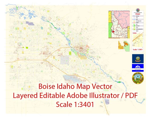
A general overview of the economic and transportation aspects of Boise, Idaho.
Vectormap.Net provide you with the most accurate and up-to-date vector maps in Adobe Illustrator, PDF and other formats, designed for editing and printing. Please read the vector map descriptions carefully.
Economic Overview:
Boise, the capital city of Idaho, has experienced significant economic growth and diversification in recent years. Key sectors contributing to the city’s economy include technology, healthcare, manufacturing, agriculture, and tourism.
- Technology Sector: Boise has emerged as a hub for technology companies, particularly in the semiconductor and electronics industries. Firms such as Micron Technology, a major player in the semiconductor industry, have a significant presence in the area.
- Healthcare: The healthcare sector is also a vital component of Boise’s economy. The city is home to several hospitals, medical research facilities, and healthcare providers.
- Manufacturing: Manufacturing plays a crucial role, with industries ranging from electronics to food processing. The city has a diverse manufacturing base contributing to job creation and economic stability.
- Agriculture: Agriculture has historical significance in Idaho, and Boise is no exception. The region is known for its potato production, and agriculture continues to be an important contributor to the local economy.
- Tourism: Boise attracts tourists with its outdoor recreational opportunities, cultural events, and a vibrant downtown area. The city hosts various festivals, concerts, and sporting events throughout the year, contributing to the tourism sector.
Transportation Overview:
Boise has a well-developed transportation infrastructure, facilitating the movement of goods and people within the city and connecting it to other regions.
- Air Transportation: The Boise Airport (Boise Airport/Gowen Field) is the primary air transportation hub, providing domestic flights to major cities across the United States.
- Road Transportation: Boise is well-connected by a network of highways, including Interstate 84, which connects the city to major cities in the region such as Portland and Salt Lake City. Local transportation includes a system of well-maintained roads and public transportation options.
- Public Transportation: Valley Regional Transit operates the public transportation system in the Boise area, offering bus services that connect various parts of the city and nearby communities.
- Rail Transportation: While Boise is not a major hub for rail transportation, Union Pacific Railroad serves the area, facilitating the movement of goods.
- Biking and Walking: Boise has invested in making the city more bike-friendly with designated bike lanes and paths. The city also promotes walking as a mode of transportation, particularly in the downtown area.
Keep in mind that economic and transportation landscapes can evolve, so it’s recommended to check more recent sources for the latest information on Boise’s economic and transportation status.


 Author: Kirill Shrayber, Ph.D. FRGS