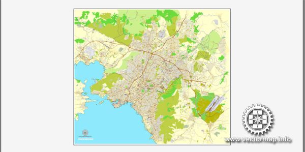
A general overview of the economic and transportation aspects of Athens, Greece.
Vectormap.Net provide you with the most accurate and up-to-date vector maps in Adobe Illustrator, PDF and other formats, designed for editing and printing. Please read the vector map descriptions carefully.
Economic Overview:
- GDP and Sectors: Athens is the capital and largest city of Greece, playing a significant role in the country’s economy. The Greek economy has historically been diverse, with sectors like tourism, shipping, agriculture, and services contributing significantly. However, Greece faced economic challenges, including a debt crisis, in the past.
- Tourism: Tourism is a crucial part of Athens’ economy. The city is known for its rich history, ancient landmarks (such as the Acropolis), and vibrant culture. Tourists contribute significantly to the local economy through spending on accommodations, restaurants, and various cultural attractions.
- Shipping Industry: Greece has one of the world’s largest shipping fleets, and Athens, being the capital, is a hub for maritime activities. The shipping industry plays a crucial role in the country’s economy, contributing to both national and local prosperity.
- Services and Financial Sector: Athens is home to various financial institutions, including banks and insurance companies. The services sector, including finance and real estate, is an important contributor to the city’s economic output.
- Trade and Commerce: Athens serves as a major center for trade and commerce, with businesses engaged in both domestic and international trade. The city’s strategic location makes it a key player in the economic activities of the region.
Transportation Overview:
- Public Transportation: Athens has an extensive public transportation system, including buses, trolleys, trams, and the Athens Metro. The Athens Metro, in particular, is a fast and efficient way to navigate the city. Public transportation is vital for daily commuting and is well-utilized by both residents and tourists.
- Road Network: Athens has a well-developed road network, but traffic congestion can be an issue, especially during peak hours. The city has implemented measures to improve traffic flow, and various expressways connect Athens to other parts of Greece.
- Airports: Athens International Airport, Eleftherios Venizelos, is the major international gateway to Greece. It is located approximately 20 kilometers east of the city center. The airport handles a large volume of both domestic and international flights, contributing to Athens’ connectivity and accessibility.
- Ports: The Port of Piraeus, located near Athens, is one of the largest and busiest ports in Europe. It serves as a major hub for ferry connections to the Greek islands and is a key component of Greece’s maritime trade.
- Rail Network: The rail network in Athens connects the city with other parts of Greece. While not as extensive as the road network, it provides an alternative mode of transportation for both passengers and freight.
It’s essential to check for the latest developments and changes, as economic and transportation landscapes can evolve over time.


 Author: Kirill Shrayber, Ph.D.