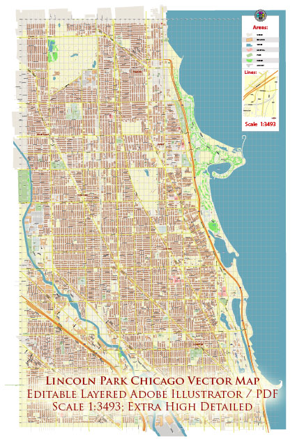
A general overview of the infrastructure in Lincoln Park, Chicago. Vectormap.Net provide you with the most accurate and up-to-date vector maps in Adobe Illustrator, PDF and other formats, designed for editing and printing. Please read the vector map descriptions carefully. Here’s a breakdown of key aspects of infrastructure:
- Transportation:
- Roads and Streets: Lincoln Park is well-connected by a network of roads and streets. Major thoroughfares include Lake Shore Drive, which runs along the eastern edge of the neighborhood, and North Avenue and Diversey Parkway, which serve as important east-west connectors.
- Public Transit: The Chicago Transit Authority (CTA) provides public transportation services in the area. Bus routes and the CTA’s “L” train system, particularly the Brown, Purple, and Red Lines, serve Lincoln Park, providing residents with convenient access to downtown Chicago and other neighborhoods.
- Biking and Pedestrian Infrastructure:
- Lincoln Park is known for its pedestrian-friendly streets and bike-friendly atmosphere. The neighborhood has bike lanes and dedicated paths, making it accessible for cyclists and pedestrians. Additionally, the lakefront area offers scenic paths for walking, jogging, and cycling.
- Education and Institutions:
- Schools: Lincoln Park is home to various educational institutions, including DePaul University, contributing to the educational infrastructure of the neighborhood.
- Libraries: The Chicago Public Library system has branches in and around Lincoln Park, providing residents with access to library services and resources.
- Healthcare:
- Hospitals and Clinics: There are healthcare facilities and clinics in and around Lincoln Park, providing residents with access to medical services. Major hospitals in nearby areas contribute to the overall healthcare infrastructure.
- Utilities:
- Water and Sewer: The neighborhood is connected to the city’s water and sewer systems, maintained by the Chicago Department of Water Management.
- Electricity and Gas: Utility services, including electricity and natural gas, are provided by local utility companies.
- Recreation and Parks:
- Lincoln Park itself is a significant part of the neighborhood’s infrastructure, offering recreational facilities, green spaces, and cultural attractions. This includes sports fields, playgrounds, the Lincoln Park Zoo, and the Peggy Notebaert Nature Museum.
- Commercial and Retail Infrastructure:
- Lincoln Park has a diverse range of commercial areas, including shopping districts, restaurants, and entertainment venues. Armitage Avenue, Halsted Street, Lincoln Avenue, and Clark Street are notable areas with a mix of businesses.
- Emergency Services:
- Police and fire services are provided by the City of Chicago, and there are local police stations and firehouses serving the Lincoln Park neighborhood.
Infrastructure in urban areas is subject to ongoing development and changes. For the latest and most accurate information, it’s recommended to check with local authorities or recent sources for any updates or new projects in Lincoln Park, Chicago.


 Author: Kirill Shrayber, Ph.D. FRGS