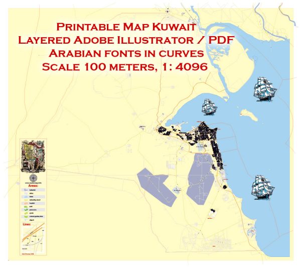
Kuwait City is divided into several districts and neighborhoods, each with its own unique characteristics, attractions, and features. Vectormap.Net provide you with the most accurate and up-to-date vector maps in Adobe Illustrator, PDF and other formats, designed for editing and printing. Please read the vector map descriptions carefully. Here are descriptions of some prominent districts and neighborhoods in Kuwait City:
- Sharq:
- Located in the heart of Kuwait City, Sharq is a central business district. It is home to many commercial and financial institutions, upscale shopping malls, and modern office buildings.
- Landmarks include the iconic Kuwait Towers and the Sharq Mall. The area is known for its skyline and vibrant atmosphere.
- Mirqab:
- Mirqab is a residential and commercial district, known for its mix of modern and traditional architecture. It is close to the waterfront and features luxury residences, hotels, and shopping centers.
- The Grand Mosque, one of Kuwait’s largest mosques, is located in Mirqab.
- Salmiya:
- Salmiya is a bustling residential and commercial area along the Arabian Gulf. It is known for its extensive shopping options, diverse restaurants, and entertainment venues.
- The Scientific Center, a popular educational and entertainment facility, is located in Salmiya. The area is also known for its beachfront promenade.
- Hawally:
- Hawally is a residential district that offers a mix of housing options, from apartments to villas. It has a diverse population and is known for its local markets, restaurants, and community facilities.
- The eponymous Hawally Park is a green space popular for recreation and relaxation.
- Fintas:
- Fintas is a suburban area located to the south of Kuwait City. It is known for its residential compounds, schools, and healthcare facilities.
- The area is relatively quieter than the central districts, making it attractive for families seeking a suburban lifestyle.
- Jabriya:
- Jabriya is a residential district with a mix of housing types, including apartments and villas. It is known for hosting several educational institutions, including Kuwait University and various schools.
- The area has a lively atmosphere with shopping centers, parks, and dining options.
- Salwa:
- Salwa is a residential area known for its family-friendly environment. It offers a mix of housing options and has schools, mosques, and parks.
- The area is situated in close proximity to the Arabian Gulf and provides a more tranquil living experience.
- Abdullah Al-Salem:
- Named after the former Amir of Kuwait, Sheikh Abdullah Al-Salem, this district is known for its cultural and historical significance. It houses the Kuwait National Museum and the Sadu House, promoting traditional Kuwaiti crafts.
- Kuwait Free Trade Zone (Shuwaikh Port):
- Shuwaikh Port area is known for its industrial and commercial activities, including the Kuwait Free Trade Zone. It is a significant hub for trade and logistics.
These descriptions provide a general overview of some of the districts and neighborhoods in Kuwait City.


 Author: Kirill Shrayber, Ph.D.