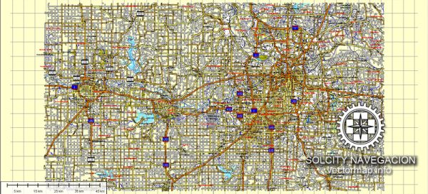
Kansas City, Lawrence, and Topeka are three distinct cities in the U.S. state of Kansas, each with its own unique characteristics and history.
Vectormap.Net provide you with the most accurate and up-to-date vector maps in Adobe Illustrator, PDF and other formats, designed for editing and printing. Please read the vector map descriptions carefully.
- Kansas City:
- Location: Kansas City is located on the western edge of Missouri, near the confluence of the Kansas and Missouri rivers. It is a bi-state city, with portions extending into both Kansas and Missouri.
- History: The city has a rich history, with roots dating back to the 1830s. It played a significant role in the expansion of the United States westward and became a major transportation and trade hub.
- Economy: Kansas City is known for its diverse economy, including sectors like agriculture, manufacturing, finance, and technology. The city is famous for its barbeque and jazz music scene.
- Culture: The city boasts a vibrant cultural scene, with numerous museums, theaters, and music venues. The Nelson-Atkins Museum of Art and the National World War I Museum and Memorial are notable attractions.
- Lawrence:
- Location: Lawrence is situated along the banks of the Kansas River in the northeastern part of the state. It is part of the larger Kansas City metropolitan area but maintains its own distinct identity.
- History: Lawrence has a unique history as a Free-State stronghold during the Bleeding Kansas era, a prelude to the Civil War. It played a pivotal role in the abolitionist movement.
- Education: The city is home to the University of Kansas, a major research university. The presence of the university contributes significantly to Lawrence’s cultural and intellectual environment.
- Cultural Scene: Lawrence has a lively arts and music scene, with numerous galleries, theaters, and live music venues. Massachusetts Street, the main street in downtown Lawrence, is known for its eclectic mix of shops and restaurants.
- Topeka:
- Location: Topeka, the capital city of Kansas, is located in the northeastern part of the state, along the Kansas River.
- Government: As the state capital, Topeka is home to the Kansas State Capitol building. The city has a governmental and administrative focus, with numerous state offices and agencies.
- Economy: Topeka’s economy is diverse, with sectors such as manufacturing, healthcare, and education playing key roles. The city has seen development in recent years, contributing to its economic growth.
- Attractions: Notable attractions include the Kansas Museum of History, the Topeka Zoo, and the Combat Air Museum. Gage Park is a popular destination for recreational activities.
While these cities share some commonalities as part of the state of Kansas, each has its own unique character, history, and contributions to the region’s culture and economy.


 Author: Kirill Shrayber, Ph.D. FRGS