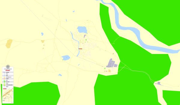
Kadapa, officially known as YSR Kadapa, is a city in the southern part of the Indian state of Andhra Pradesh. It is the district headquarters of the YSR Kadapa district. Here is a detailed description of Kadapa:
Geography: Kadapa is situated in the Rayalaseema region of Andhra Pradesh, India. It is located at a geographical coordinates of approximately 14.47°N latitude and 78.82°E longitude. The city is surrounded by the Nallamala Hills to the west and the Seshachalam Hills to the east, making the topography diverse and picturesque.
History: The history of Kadapa dates back to ancient times, and the region has seen the rule of various dynasties, including the Mauryas, Cholas, Pallavas, Chalukyas, and Vijayanagara Empire. The city has a rich historical and cultural heritage, with several historical monuments and temples that reflect the influence of different rulers.
Economy: Kadapa’s economy is primarily based on agriculture. The region is known for its production of crops like groundnut, sunflower, and cotton. The presence of limestone deposits has also led to the development of the cement industry, contributing to the economic growth of the area. Additionally, the city serves as a trading center for the surrounding rural areas.
Culture: The culture of Kadapa is a blend of traditional and modern influences. The city celebrates various festivals with great fervor, and religious events hold significant importance. The people of Kadapa are known for their warm hospitality and traditional values. The cuisine of the region is typically South Indian, with a variety of vegetarian and non-vegetarian dishes.
Tourist Attractions: Kadapa has several tourist attractions that showcase its historical and cultural significance. Some notable places include:
- Gandi Anjaneya Swamy Temple: A famous temple dedicated to Lord Hanuman, located on the Gandi Kshetram hill.
- Ameen Peer Dargah: A revered Muslim shrine dedicated to Ameen Peer Baba, attracting devotees from different communities.
- Brahmamgari Matham: A spiritual center associated with the sage Brahmamgari, known for his prophetic insights.
- Sri Venkateswara Wildlife Sanctuary: Located in the nearby Seshachalam Hills, the sanctuary is home to a diverse range of flora and fauna.
Transportation: Kadapa is well-connected by road and rail. The National Highway 40 passes through the city, providing good connectivity to major cities in Andhra Pradesh and neighboring states. The Kadapa Railway Station is an important railway junction in the region, facilitating both passenger and freight services.
In summary, Kadapa is a city with a rich historical and cultural heritage, surrounded by natural beauty. It plays a significant role in the agricultural and industrial sectors of Andhra Pradesh, making it an important center in the region.
Vectormap.Net provide you with the most accurate and up-to-date vector maps in Adobe Illustrator, PDF and other formats, designed for editing and printing. Please read the vector map descriptions carefully.


 Author: Kirill Shrayber, Ph.D. FRGS