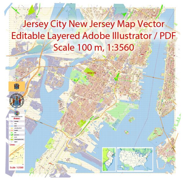
A general overview of the infrastructure in Jersey City, New Jersey. Vectormap.Net provide you with the most accurate and up-to-date vector maps in Adobe Illustrator, PDF and other formats, designed for editing and printing. Please read the vector map descriptions carefully.
- Transportation:
- Roads and Highways: Jersey City is well-connected by a network of roads and highways, including the New Jersey Turnpike and Routes 1 and 9. The Pulaski Skyway is a significant elevated highway connecting Jersey City to Newark.
- Public Transportation: The city has a comprehensive public transportation system. NJ Transit operates buses and trains that connect Jersey City to New York City and other parts of New Jersey.
- Public Transit:
- PATH (Port Authority Trans-Hudson): The PATH train system connects Jersey City to Manhattan, providing a vital link for daily commuters.
- Light Rail: The Hudson-Bergen Light Rail system serves various neighborhoods in Jersey City, providing an additional mode of public transportation.
- Bridges and Tunnels:
- Holland Tunnel: This tunnel connects Jersey City to Lower Manhattan in New York City.
- Jersey City Viaduct: This elevated structure provides a connection for road traffic over the city.
- Airports:
- Newark Liberty International Airport: While not located within Jersey City, Newark Airport is nearby and serves as a major international airport for the region.
- Utilities:
- Water and Sewer Systems: Jersey City has a well-maintained water and sewer infrastructure.
- Energy: The city is part of the broader energy grid, and utilities provide electricity and gas to residents and businesses.
- Public Facilities:
- Parks and Recreation: Jersey City has numerous parks and recreational areas for residents. Liberty State Park, located in the southern part of the city, is a significant recreational space.
- Schools and Hospitals: The city has various educational institutions and healthcare facilities.
- Urban Development:
- Skyscrapers: Jersey City has seen significant urban development, with numerous high-rise buildings and residential complexes.
- Waterfront Development: The waterfront area has been a focus of redevelopment, with parks, commercial spaces, and residential developments.
- Cultural and Historic Sites:
- Liberty Science Center: This interactive science museum is located in Liberty State Park.
- Colgate Clock: An iconic clock located near the waterfront.
It’s important to check with local authorities or recent sources for the most up-to-date information on Jersey City’s infrastructure and any ongoing or planned projects.


 Author: Kirill Shrayber, Ph.D. FRGS