Jakarta, Indonesia, has been undergoing significant infrastructure development to address challenges such as traffic congestion, flooding, and inadequate public services. Here is an overview of key aspects of Jakarta’s infrastructure:
- Transportation:
- Mass Rapid Transit (MRT): Jakarta has implemented its MRT system, connecting the southern and central parts of the city. It has helped alleviate traffic congestion and provides a faster mode of transportation.
- Commuter Line: The city has an extensive commuter train network, connecting Jakarta with its satellite cities, making it easier for people to travel to and from work.
- Bus Rapid Transit (BRT): Jakarta has a BRT system that aims to provide efficient public transportation along major corridors.
- Toll Roads: The city has an extensive network of toll roads to facilitate smoother traffic flow, connecting different parts of Jakarta and its outskirts.
- Flood Mitigation:
- Jakarta faces challenges related to flooding due to its low-lying topography and rapid urbanization. Various projects and initiatives, such as the Jakarta Coastal Defense Strategy, have been implemented to mitigate flooding risks.
- Urban Planning and Development:
- Reclamation Projects: Jakarta has seen several reclamation projects, including the development of artificial islands in the Jakarta Bay. These projects aim to create new areas for business, housing, and recreation.
- Smart City Initiatives: The city has been working on becoming a smart city, incorporating technology to improve governance, public services, and the overall quality of life for residents.
- Water Supply and Sanitation:
- Clean Water Supply: Efforts have been made to improve access to clean water in Jakarta, addressing challenges related to water scarcity and distribution.
- Waste Management: The city has been working on enhancing waste management systems to handle the increasing urban population’s waste.
- Airport Infrastructure:
- Soekarno-Hatta International Airport: As the main international gateway to Indonesia, the airport has undergone expansions and improvements to accommodate the growing number of passengers.
- Housing and Urban Development:
- Affordable Housing Programs: Initiatives have been launched to provide affordable housing for low-income residents, addressing the city’s housing needs.
It’s important to note that Jakarta is a dynamic city, and infrastructure development is an ongoing process.
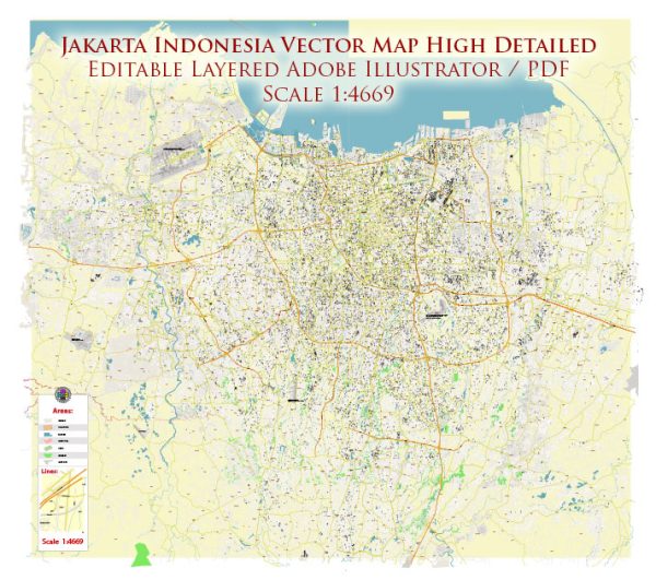
Vectormap.Net provide you with the most accurate and up-to-date vector maps in Adobe Illustrator, PDF and other formats, designed for editing and printing. Please read the vector map descriptions carefully.


 Author: Kirill Shrayber, Ph.D. FRGS