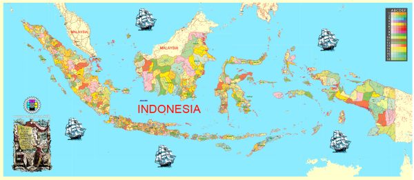
A general overview of Indonesia’s urban layout and transportation infrastructure. Vectormap.Net provide you with the most accurate and up-to-date vector maps in Adobe Illustrator, PDF and other formats, designed for editing and printing. Please read the vector map descriptions carefully.
Urban Layout:
- Java Island Dominance: The majority of Indonesia’s urban development is concentrated on the island of Java, particularly in the greater Jakarta metropolitan area. Jakarta, the capital city, is the largest and most populous city in Indonesia.
- Urban Centers: Besides Jakarta, other significant urban centers include Surabaya (East Java), Bandung (West Java), Medan (North Sumatra), and Makassar (South Sulawesi).
- Urbanization Challenges: Rapid urbanization has led to challenges such as traffic congestion, inadequate housing, and strained public services.
Transportation Infrastructure:
- Roads: Indonesia has an extensive road network, with highways connecting major cities and towns. However, traffic congestion, especially in Jakarta, is a significant issue.
- Public Transportation:
- TransJakarta: Jakarta has a Bus Rapid Transit (BRT) system called TransJakarta, which aims to provide a more efficient and reliable mode of public transportation.
- Commuter Trains: Jakarta also has a commuter train system connecting the city center with suburban areas.
- Airports: Indonesia has numerous airports, with major international airports in Jakarta, Bali, Surabaya, and other cities. The Soekarno-Hatta International Airport in Jakarta is the main gateway to the country.
- Ports: Given its archipelagic nature, Indonesia relies heavily on maritime transportation. Major ports include Tanjung Priok (Jakarta), Tanjung Perak (Surabaya), and Belawan (Medan).
- Railways: The railway network is being developed and expanded, with both passenger and freight services. The government has initiated projects to improve connectivity through high-speed rail.
- Bridges and Tunnels: Iconic structures like the Suramadu Bridge, connecting Surabaya and Madura Island, demonstrate efforts to improve transportation infrastructure.
- Challenges and Future Plans: Despite improvements, challenges persist, including traffic congestion, insufficient public transportation coverage, and the need for further infrastructure development. The government has outlined plans for infrastructure projects to address these issues.
Please note that ongoing developments and changes in Indonesia’s urban layout and transportation infrastructure may not be reflected in this response. For the latest information, it’s advisable to consult recent sources or official government reports.


 Author: Kirill Shrayber, Ph.D. FRGS