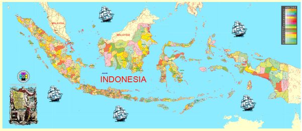
Indonesia has been actively working on developing its infrastructure to support economic growth and improve living standards. Vectormap.Net provide you with the most accurate and up-to-date vector maps in Adobe Illustrator, PDF and other formats, designed for editing and printing. Please read the vector map descriptions carefully. Here is an overview of Indonesia’s infrastructure:
- Transportation Infrastructure:
- Roads: Indonesia has an extensive road network, but some regions, especially remote areas, may still face connectivity challenges.
- Ports: Major ports like Tanjung Priok in Jakarta, Tanjung Perak in Surabaya, and Belawan in Medan play crucial roles in facilitating trade.
- Airports: Major airports, including Soekarno-Hatta International Airport in Jakarta and Ngurah Rai International Airport in Bali, contribute to the country’s air connectivity.
- Railway Infrastructure:
- The government has been investing in railway projects to improve transportation efficiency. Projects such as the Jakarta-Bandung High-Speed Rail are aimed at reducing travel time between major cities.
- Energy Infrastructure:
- Indonesia relies heavily on a mix of energy sources, including coal, natural gas, and renewable energy. The government has been investing in expanding its renewable energy capacity to reduce reliance on fossil fuels.
- Telecommunications Infrastructure:
- The country has seen significant growth in the telecommunications sector, with widespread mobile phone usage and increasing internet penetration. Efforts have been made to improve broadband connectivity, especially in rural areas.
- Water and Sanitation:
- Water supply and sanitation infrastructure vary across regions. Efforts are ongoing to improve access to clean water and sanitation facilities, particularly in rural areas.
- Public Facilities:
- Indonesia has been investing in public facilities such as schools and healthcare centers to improve education and healthcare services.
- Smart Cities:
- Some cities in Indonesia, including Jakarta, have been working towards becoming “smart cities” by implementing technology and data-driven solutions to improve urban living.
- Challenges:
- Despite progress, challenges such as bureaucratic hurdles, funding issues, and geographic constraints remain, especially in remote and less-developed areas.
- Future Plans:
- The Indonesian government has outlined various infrastructure development plans as part of its long-term vision, including the National Medium-Term Development Plan (RPJMN) and the National Long-Term Development Plan (RPJPN).
Keep in mind that infrastructure development is dynamic, and there may have been new projects or changes since my last update. It’s recommended to consult more recent sources or official government publications for the latest information on Indonesia’s infrastructure.


 Author: Kirill Shrayber, Ph.D. FRGS