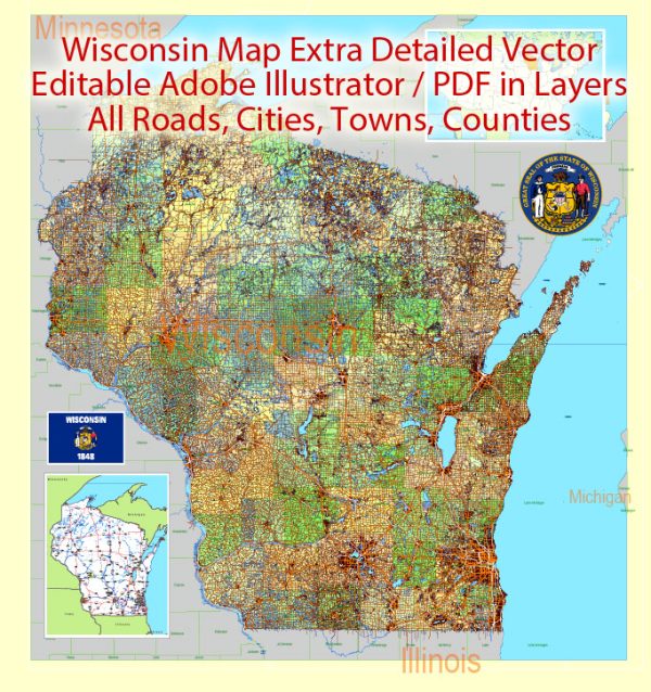
Wisconsin is a state located in the north-central region of the United States. It is known for its diverse geography, including forests, lakes, and farmland. Here are some of the principal cities, major waterways, and main roads in Wisconsin:
Principal Cities:
- Milwaukee: Located on the western shore of Lake Michigan, Milwaukee is Wisconsin’s largest city and a major economic and cultural hub.
- Madison: The state capital, situated in the south-central part of Wisconsin, is known for its beautiful lakes, including Lake Mendota and Lake Monona.
- Green Bay: Located on the western shore of Lake Michigan, Green Bay is known for its football team, the Green Bay Packers, and is an important industrial and commercial center.
- Kenosha: Located on the shores of Lake Michigan, Kenosha is in the southeastern part of the state and is known for its history and scenic lakefront.
- Racine: Another city on the shores of Lake Michigan, Racine is known for its harbor, historic architecture, and various cultural attractions.
- Appleton: Located in the Fox River Valley, Appleton is known for its paper industry and is a vibrant cultural and economic center.
- Eau Claire: Situated in the west-central part of the state, Eau Claire is known for its parks, rivers, and as a regional center for health care and education.
Major Waterways:
- Mississippi River: Forms Wisconsin’s western border, providing important transportation and recreation.
- Lake Michigan: Borders the eastern part of the state, offering recreational opportunities and influencing the climate.
- Lake Superior: Located to the north, Lake Superior influences the climate and provides scenic beauty.
- Wisconsin River: Flows through the central part of the state, offering recreational opportunities and contributing to hydroelectric power generation.
- Fox River: Flows through eastern Wisconsin, playing a significant role in the state’s history and economy.
Main Roads:
- Interstate Highways: Include I-94, I-43, I-90, and I-39, connecting major cities and facilitating transportation.
- U.S. Highways: Such as US-51, US-41, and US-151, providing additional important transportation routes.
- State Highways: A comprehensive network of state routes connecting cities and rural areas.
- Scenic Byways: Wisconsin has several scenic byways, including the Great River Road along the Mississippi River and the Door County Coastal Byway.
- County Roads: A network of roads connecting local communities and providing access to rural areas.
Vectormap.Net provide you with the most accurate and up-to-date vector maps in Adobe Illustrator, PDF and other formats, designed for editing and printing. Please read the vector map descriptions carefully.
This description provides a broad overview, and the state’s geography and infrastructure continue to evolve. Detailed maps and current travel information are recommended for specific and up-to-date details.


 Author: Kirill Shrayber, Ph.D. FRGS