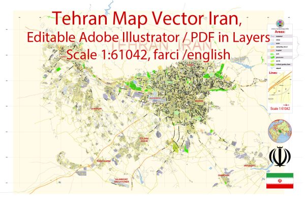
Some general information about Tehran, Iran’s principal waterways, bridges, and main streets. Vectormap.Net provide you with the most accurate and up-to-date vector maps in Adobe Illustrator, PDF and other formats, designed for editing and printing. Please read the vector map descriptions carefully.
Waterways:
Tehran is situated in a mountainous region, and there are no major rivers flowing through the city. Water supply for the city primarily comes from underground sources and reservoirs.
Bridges:
- Tabiat Bridge: One of the prominent bridges in Tehran, the Tabiat Bridge, is a multi-level, pedestrian bridge connecting two parks over the Modarres Highway.
- Pol-e-Tabiat (Nature Bridge): This bridge is not only a functional structure but also a popular recreational space with restaurants and cafes, providing panoramic views of the city.
- Mirdamad Bridge: Mirdamad Bridge is an important bridge crossing the Modarres Highway, connecting the eastern and western parts of Tehran.
Main Streets:
- Valiasr Street: Valiasr is one of Tehran’s longest and most important streets, running north to south. It is known for its shops, cultural centers, and parks.
- Enqelab Street (Revolution Street): This is a major street in Tehran, known for its historical significance and the presence of Tehran University.
- Keshavarz Boulevard: This boulevard is a significant thoroughfare in Tehran, hosting important government buildings and institutions.
- Ferdowsi Avenue: Located in the central part of Tehran, Ferdowsi Avenue is known for its commercial activities, shops, and cultural centers.
- Modarres Highway: It is a major highway that crosses the city, connecting different parts of Tehran.
- Jordan Street (Jomhouri Avenue): Jomhouri Avenue is a central street known for its historical buildings, shops, and cultural attractions.
- Shariati Avenue: Running parallel to Valiasr Street, Shariati Avenue is another important north-south artery in Tehran.
It’s important to check for updates and changes, as city infrastructure can undergo modifications and improvements over time. For the latest and most accurate information, consider consulting local sources, maps, or government resources.


 Author: Kirill Shrayber, Ph.D.