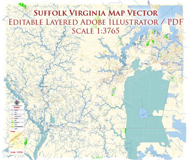
A general overview of Suffolk, Virginia’s principal waterways, bridges, and main streets. Vectormap.Net provide you with the most accurate and up-to-date vector maps in Adobe Illustrator, PDF and other formats, designed for editing and printing. Please read the vector map descriptions carefully.
Waterways:
- Nansemond River: The Nansemond River is a significant waterway in Suffolk, flowing through the city and providing access to the Chesapeake Bay. It has historically been important for transportation and trade.
- James River: While not directly flowing through Suffolk, the James River is nearby and plays a crucial role in the region’s geography and transportation.
Bridges:
- James River Bridge: This bridge connects Suffolk to Newport News and is a key transportation link in the region. It spans the James River, providing a vital connection for commuters and travelers.
- Monitor-Merrimac Memorial Bridge-Tunnel: Located nearby, this bridge-tunnel complex connects Suffolk to the city of Newport News across the Hampton Roads harbor area.
Main Streets:
- Main Street: The downtown area of Suffolk is likely to have a Main Street, which is often a hub for local businesses, shops, and cultural activities. Downtown areas usually feature historical architecture and a sense of community.
- Washington Street: Washington Street is another important thoroughfare in Suffolk, and it may have a mix of residential, commercial, and institutional establishments.
Please note that the specifics of streets, bridges, and waterways can change, and new developments may have occurred since my last update. For the most accurate and up-to-date information, it’s recommended to refer to local government resources or maps of Suffolk, Virginia.


 Author: Kirill Shrayber, Ph.D. FRGS