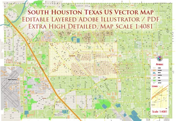
Principal waterways, bridges, and main streets in South Houston, Texas, some general information about these features in a typical city or region. Vectormap.Net provide you with the most accurate and up-to-date vector maps in Adobe Illustrator, PDF and other formats, designed for editing and printing. Please read the vector map descriptions carefully.
Waterways:
- Buffalo Bayou: Buffalo Bayou is a significant waterway in the Houston area, and it might have an impact on the South Houston region.
Bridges:
- I-610 South Loop: The South Loop is a major freeway in Houston, and it likely has multiple bridges crossing various waterways or roads within the South Houston area.
- Sam Houston Tollway (Beltway 8): This is another major highway encircling Houston, and it may have several bridges connecting different parts of South Houston.
Main Streets:
- South Shaver Street: This is a major road that runs through South Houston and may serve as a central thoroughfare.
- Spencer Highway: Another important road that might connect different parts of South Houston.
Keep in mind that new developments or changes in infrastructure could have occurred since my last update. For the most accurate and current information, consider checking with local city authorities, transportation departments, or using online maps and navigation tools.


 Author: Kirill Shrayber, Ph.D. FRGS