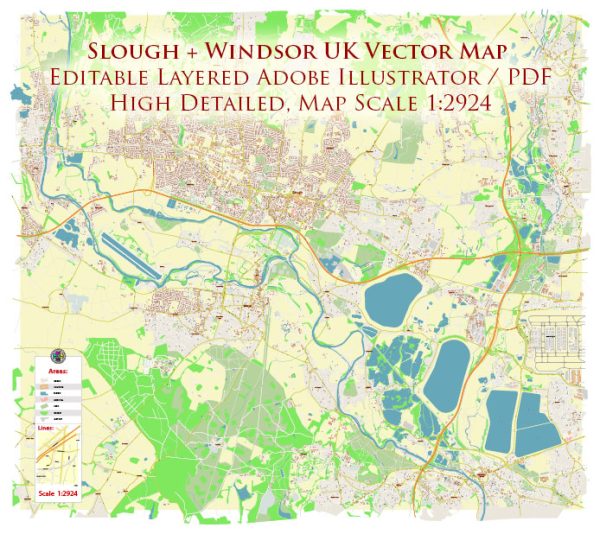
Slough and Windsor are neighboring towns in Berkshire, England, situated to the west of London. The area is characterized by a mix of urban and suburban landscapes, and it is traversed by various waterways, bridges, and main streets. Here’s a description of some principal waterways, bridges, and main streets in the Slough and Windsor area:
Waterways:
- River Thames: The River Thames flows through the area, providing a significant waterway. It is a major river in the United Kingdom and plays a central role in the region’s geography.
- Slough Arm (Grand Union Canal): The Grand Union Canal has a branch known as the Slough Arm, which connects Slough to the main canal network. Canals like these were historically important for transportation and industry.
Bridges:
- Windsor Bridge: Windsor Bridge spans the River Thames, connecting Windsor in Berkshire to Eton in Buckinghamshire. The current bridge is a modern structure, but there has been a crossing at this location since the medieval period.
- Slough Arm Bridge: There are various bridges along the Slough Arm of the Grand Union Canal, facilitating local transportation and offering scenic views of the waterway.
Main Streets:
- High Street, Windsor: Windsor’s High Street is a bustling thoroughfare lined with shops, restaurants, and historic buildings. It leads to Windsor Castle, a prominent landmark in the area.
- Queensmere Shopping Centre, Slough: Queensmere Shopping Centre is a major retail destination in Slough, featuring a variety of stores and amenities.
- Wellington Street, Slough: This street runs through the town center of Slough and is home to various shops, offices, and services.
- Stoke Road, Slough: Another important road in Slough, Stoke Road is known for its commercial activity and is a key route for local transportation.
These are just a few examples, and the area has a network of streets and roads connecting various neighborhoods, parks, and commercial areas. The River Thames and the Grand Union Canal contribute to the scenic and navigational aspects of the region. The towns of Slough and Windsor are well-connected, offering a mix of historical charm and modern amenities.


 Author: Kirill Shrayber, Ph.D. FRGS