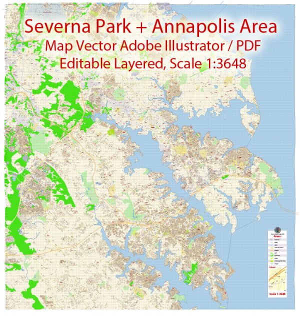
Severna Park and Annapolis are two communities in Maryland, United States, each with its own distinct characteristics and features. Here’s a brief description of their principal waterways, bridges, and main streets:
Severna Park:
- Waterways:
- Severna Park is situated along the Severn River, providing residents with waterfront views and recreational opportunities.
- Cypress Creek is another water body that flows through the area.
- Bridges:
- While Severna Park doesn’t have any major bridges of its own, nearby areas may have bridges connecting different parts of the region.
- Main Streets:
- Ritchie Highway (Maryland Route 2) is a major road that runs through Severna Park, serving as a primary route for commuters and providing access to various businesses and amenities.
- Baltimore & Annapolis Trail is a popular multi-use trail that used to be a rail line, offering a scenic route for walking, running, and biking.
Annapolis:
- Waterways:
- Annapolis is known for its picturesque waterfront along the Chesapeake Bay and the Severn River.
- Ego Alley is a famous narrow waterway in downtown Annapolis, lined with marinas and frequented by boaters.
- Bridges:
- The Chesapeake Bay Bridge is a significant nearby bridge, connecting the Eastern and Western Shores of Maryland. While not directly in Annapolis, it’s an important regional landmark.
- Main Streets:
- Main Street in downtown Annapolis is a historic and vibrant area with a mix of shops, restaurants, and colonial architecture.
- West Street is another notable street, offering a diverse range of dining and shopping experiences.
- Maryland Avenue is a charming street with historic homes, boutiques, and art galleries.
Both Severna Park and Annapolis offer a mix of residential and commercial spaces, as well as recreational opportunities along the water. The historic and nautical atmosphere of Annapolis contrasts with the more suburban feel of Severna Park, providing diverse living environments within close proximity to each other.
Vectormap.Net provide you with the most accurate and up-to-date vector maps in Adobe Illustrator, PDF and other formats, designed for editing and printing. Please read the vector map descriptions carefully.


 Author: Kirill Shrayber, Ph.D. FRGS