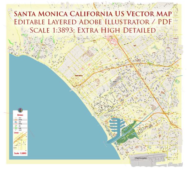
Santa Monica, California, is a coastal city located in Los Angeles County. While it doesn’t have significant natural waterways like rivers, there are some notable features in terms of streets and bridges:
- Pacific Coast Highway (PCH):
- The Pacific Coast Highway is a major north-south highway that runs along the coast of California. In Santa Monica, it is a prominent roadway offering scenic views of the Pacific Ocean. It is a vital route connecting various coastal cities.
- Santa Monica Pier:
- The Santa Monica Pier is an iconic attraction with an amusement park, aquarium, and family-friendly restaurants. It extends over the Pacific Ocean, providing breathtaking views. The pier is located at the intersection of Colorado Avenue and Ocean Avenue.
- Ocean Avenue:
- Ocean Avenue runs parallel to the coastline and is known for its upscale residential properties, hotels, and oceanfront parks. It’s a picturesque street with palm trees lining the sidewalks.
- Main Street:
- Main Street is a vibrant commercial and entertainment district in Santa Monica. It features a mix of boutique shops, restaurants, cafes, and art galleries. The street has a relaxed, beach-town atmosphere and is a popular destination for locals and visitors alike.
- Colorado Avenue:
- Colorado Avenue is a major east-west thoroughfare in Santa Monica. It intersects with Ocean Avenue and leads to the Santa Monica Pier. It serves as a primary route for accessing the downtown area and the beach.
- Wilshire Boulevard:
- While not directly in Santa Monica, Wilshire Boulevard is a significant thoroughfare that connects Santa Monica to downtown Los Angeles. It passes through the nearby neighborhoods of West Los Angeles and Brentwood.
- Bridges:
- Santa Monica doesn’t have many large bridges, but the Santa Monica Pier has a famous bridge that leads to its entrance. This bridge offers views of the coastline and is often featured in photographs of the pier.
- Palisades Park:
- Although not a street, Palisades Park is a notable green space offering stunning views of the Pacific Ocean. It runs along Ocean Avenue and provides a picturesque setting with walking paths, gardens, and expansive lawns.
Santa Monica’s urban layout is designed to take advantage of its coastal location, with many streets oriented towards the ocean to capture the beautiful seaside views. The city’s infrastructure is well-integrated with its natural surroundings, making it a popular destination for residents and tourists alike.
Vectormap.Net provide you with the most accurate and up-to-date vector maps in Adobe Illustrator, PDF and other formats, designed for editing and printing. Please read the vector map descriptions carefully.


 Author: Kirill Shrayber, Ph.D. FRGS