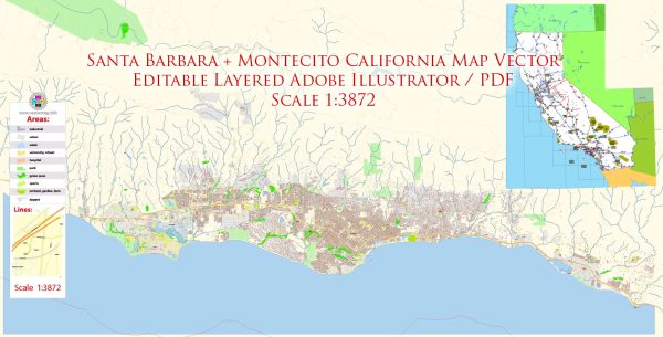
Santa Barbara and Montecito are located in Santa Barbara County, California, and they are known for their beautiful coastal landscapes, Spanish-style architecture, and upscale communities. Here’s an overview of some principal waterways, bridges, and main streets in the Santa Barbara and Montecito areas:
Santa Barbara:
1. Waterways:
- Pacific Ocean: The city is situated along the Pacific coastline, providing stunning ocean views and access to beaches like East Beach and West Beach.
- Mission Creek: A waterway that flows through the city and has historical significance. The Old Mission Santa Barbara is located near its banks.
2. Bridges:
- Mason Street Overcrossing: A notable bridge in downtown Santa Barbara that spans over Highway 101.
- Garden Street Bridge: Another bridge in the city that offers picturesque views of the surrounding area.
3. Main Streets:
- State Street: The main thoroughfare in downtown Santa Barbara, lined with shops, restaurants, and cultural attractions. State Street is known for its vibrant atmosphere and Spanish-style architecture.
- Cabrillo Boulevard: Runs along the waterfront, offering a scenic route with palm-lined streets and views of the ocean.
- Milpas Street: Known for its diverse range of shops and eateries, reflecting the cultural diversity of the community.
Montecito:
1. Waterways:
- Montecito Creek: Flows through the community, providing a natural and scenic element to the area.
- San Ysidro Creek: Another creek that traverses Montecito, contributing to the picturesque landscapes.
2. Bridges:
- San Ysidro Road Bridge: A bridge that spans over San Ysidro Creek and is part of the charming scenery in Montecito.
- East Valley Road Bridge: Crosses over Montecito Creek and is an important infrastructure element in the area.
3. Main Streets:
- East Valley Road: One of the main roads in Montecito, known for its tree-lined streets and upscale residences.
- Coast Village Road: A charming street with boutique shops, high-end restaurants, and a relaxed atmosphere. It’s a central part of Montecito’s commercial area.
Both Santa Barbara and Montecito offer a mix of natural beauty and well-planned urban spaces, making them popular destinations for residents and visitors alike. The area is characterized by its Mediterranean climate, which contributes to the overall appeal of the region.
Vectormap.Net provide you with the most accurate and up-to-date vector maps in Adobe Illustrator, PDF and other formats, designed for editing and printing. Please read the vector map descriptions carefully.


 Author: Kirill Shrayber, Ph.D. FRGS