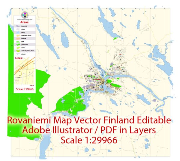
Rovaniemi is the capital of Lapland, Finland, and is located at the confluence of the Kemijoki River and its tributary, the Ounasjoki River. Vectormap.Net provide you with the most accurate and up-to-date vector maps in Adobe Illustrator, PDF and other formats, designed for editing and printing. Please read the vector map descriptions carefully.
Waterways:
- Kemijoki River: Rovaniemi is situated on the northern bank of the Kemijoki River, the longest river in Finland. The river flows through the city and is a significant geographical feature.
- Ounasjoki River: This is a tributary of the Kemijoki River, and it joins the Kemijoki near the city center of Rovaniemi.
Bridges:
- Jätkänkynttilä Bridge (Lumberjack’s Candle Bridge): One of the iconic landmarks in Rovaniemi, this bridge spans the Kemijoki River. It is a cable-stayed bridge with a distinctive, candle-like shape, symbolizing the long Finnish winters.
- Lumberjack’s Bridge (Jätkänkynttilänsilta): Another bridge over the Kemijoki River, the Lumberjack’s Bridge is an arch bridge located near the Arktikum Science Center.
- Lordin Aukio Bridge: This is a pedestrian bridge that connects the city center to the Ounaskoski area.
Main Streets:
- Koskikatu: This street runs along the northern bank of the Kemijoki River and is a central street in Rovaniemi. It hosts various shops, restaurants, and businesses.
- Rovakatu: Rovakatu is a major street that passes through the city center, featuring shopping areas, offices, and other amenities.
- Hallituskatu: Located in the city center, Hallituskatu is known for its shops, cafes, and services.
- Pohjolankatu: This street runs parallel to the Kemijoki River and is part of the road network in Rovaniemi.
It’s important to check with local sources or maps for the most up-to-date information, as urban infrastructure can change over time.


 Author: Kirill Shrayber, Ph.D. FRGS