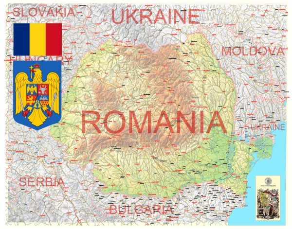
Romania, located in southeastern Europe, is known for its diverse geography, which includes the Carpathian Mountains, hills, and plains. Here’s a brief description of some of Romania’s principal cities, waterways, and main roads:
Principal Cities:
- Bucharest: The capital and largest city of Romania, Bucharest is a vibrant cultural and economic hub. It is known for its eclectic architecture, including the massive Parliament Palace, the second-largest administrative building in the world.
- Cluj-Napoca: Located in the northwestern part of the country, Cluj-Napoca is an important academic, cultural, and industrial center. It is home to several universities and a thriving tech industry.
- Timișoara: Situated in the western part of Romania, Timișoara is often referred to as the “City of Roses” and is known for its rich history and architecture. It played a significant role in the 1989 Romanian Revolution.
- Iași: Located in northeastern Romania, Iași is one of the country’s oldest cities and a cultural and educational center. It houses several universities and historical landmarks.
- Constanta: A major port city on the Black Sea coast, Constanta is an important economic center and a popular tourist destination. It boasts archaeological sites and a mix of ancient and modern architecture.
Waterways:
- Danube River: The Danube, Europe’s second-longest river, flows through Romania, offering vital transportation and trade routes. The Iron Gate, a series of gorges and rapids, is a notable feature on the Danube in Romania.
- Black Sea: Romania has a significant coastline along the Black Sea, providing opportunities for maritime trade, tourism, and recreation.
Main Roads:
- A1 Motorway (Sun Motorway): Connecting Bucharest to the western part of the country (Timișoara), the A1 is a major highway facilitating transportation and commerce.
- A2 Motorway (Sunflower Motorway): Linking Bucharest to Constanta on the Black Sea coast, the A2 is crucial for both passenger and freight transport.
- A3 Motorway (Transylvania Motorway): Under construction, the A3 aims to connect Bucharest to Cluj-Napoca and eventually to the Hungarian border, improving connectivity in the central and northwestern regions.
- E60 European Route: Passing through Romania, the E60 is a major transcontinental road connecting Brest in France to the Turkish–Bulgarian border.
These principal cities, waterways, and main roads collectively contribute to Romania’s economic development, cultural diversity, and regional connectivity. The infrastructure plays a key role in facilitating transportation, trade, and tourism across the country.
Vectormap.Net provide you with the most accurate and up-to-date vector maps in Adobe Illustrator, PDF and other formats, designed for editing and printing. Please read the vector map descriptions carefully.


 Author: Kirill Shrayber, Ph.D. FRGS