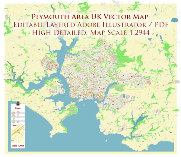
Some general information about Plymouth’s principal waterways, bridges, and main streets. Vectormap.Net provide you with the most accurate and up-to-date vector maps in Adobe Illustrator, PDF and other formats, designed for editing and printing. Please read the vector map descriptions carefully.
Waterways:
- River Plym: The River Plym flows through Plymouth, eventually reaching Plymouth Sound. It is a tidal river and has played a significant role in the city’s maritime history.
- Plymouth Sound: While not a traditional waterway, Plymouth Sound is a large natural harbor that has been crucial to Plymouth’s naval and commercial activities.
Bridges:
- Tamar Bridge: This bridge spans the River Tamar, connecting Plymouth to Saltash in Cornwall. It’s a major transportation link in the area.
- Royal Albert Bridge: This iconic bridge was designed by Isambard Kingdom Brunel and spans the River Tamar, connecting Plymouth to Saltash. It is a railway bridge with distinctive arches.
Main Streets:
- Royal Parade: Located in the city center, Royal Parade is a major street lined with shops, restaurants, and businesses. It is a central hub for shopping and entertainment.
- Armada Way: Another key street in the city center, Armada Way is known for its green spaces, statues, and cultural venues. It provides a pleasant pedestrian experience.
- Union Street: Historically known for its nightlife, Union Street is one of the main thoroughfares in Plymouth, offering a mix of entertainment, shopping, and dining.
- Mayflower Street: This street is named after the Mayflower ship, which set sail from Plymouth to the New World in 1620. It is a commercial street with shops and businesses.
Please note that urban landscapes can change, and new developments may have taken place since my last update. For the most current and detailed information, it’s recommended to consult local sources, maps, or official city websites.


 Author: Kirill Shrayber, Ph.D. FRGS