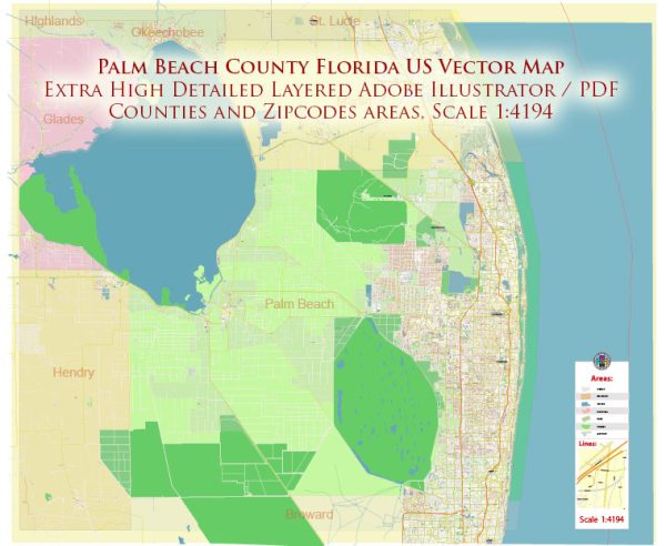
Palm Beach County in Florida, USA, is known for its diverse communities, beautiful landscapes, and vibrant cultural scene. Vectormap.Net provide you with the most accurate and up-to-date vector maps in Adobe Illustrator, PDF and other formats, designed for editing and printing. Please read the vector map descriptions carefully.
Principal Cities:
- West Palm Beach: This is the largest city and the county seat of Palm Beach County. It is known for its downtown area, Clematis Street, Norton Museum of Art, and proximity to the waterfront.
- Boca Raton: Located to the south of West Palm Beach, Boca Raton is known for its upscale communities, cultural attractions, and beautiful beaches.
- Boynton Beach: Situated between West Palm Beach and Boca Raton, Boynton Beach offers a mix of residential neighborhoods and recreational areas.
- Delray Beach: Known for its vibrant downtown, art galleries, and Atlantic Avenue, Delray Beach is a popular destination for shopping, dining, and cultural events.
- Wellington: Famous for its equestrian community and the International Polo Club Palm Beach, Wellington is located in the western part of the county.
- Jupiter: Located to the north, Jupiter is known for its scenic waterfront, outdoor recreational opportunities, and the Jupiter Inlet Lighthouse.
- Palm Beach Gardens: This city is home to the Gardens Mall and numerous golf courses, making it a hub for shopping and recreational activities.
Waterways:
- Intracoastal Waterway: Running along the eastern edge of the county, the Intracoastal Waterway provides scenic views and access to boating and water sports.
- Lake Okeechobee: To the northwest, Lake Okeechobee is the largest freshwater lake in Florida and an important water resource.
- Loxahatchee River: Flowing through parts of Palm Beach County, the Loxahatchee River is a designated National Wild and Scenic River.
Main Roads:
- Interstate 95 (I-95): A major north-south interstate highway, I-95 runs through Palm Beach County, providing crucial transportation links.
- Florida’s Turnpike: This toll road passes through the western part of the county, connecting various cities and providing a route for long-distance travel.
- U.S. Highway 1: Running parallel to the coastline, U.S. Highway 1 is a scenic route connecting many coastal communities.
- State Road 80 (Southern Boulevard): Connecting West Palm Beach to Belle Glade, this road is a major east-west route.
- State Road 7 (441): Running north-south, State Road 7 is a significant roadway connecting various communities in the western part of the county.
Please note that developments, roadways, and city profiles may have changed since my last update, so it’s advisable to check the most recent sources for accurate and up-to-date information.


 Author: Kirill Shrayber, Ph.D.