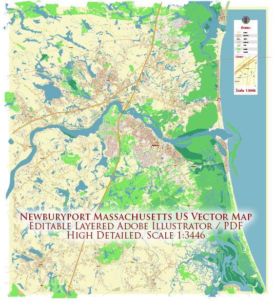
Newburyport, Massachusetts, is a historic coastal city located in Essex County. The city is situated along the Merrimack River and has a rich maritime history. Here’s a brief description of its principal waterways, bridges, and main streets:
Waterways:
- Merrimack River: The Merrimack River is the most significant waterway in Newburyport. It flows along the western edge of the city, providing scenic views and recreational opportunities. The river has played a crucial role in the city’s history, serving as a transportation route for trade and commerce.
Bridges:
- Merrimack River Bridge: Also known as the Newburyport-Plum Island Turnpike Bridge, this is a prominent bridge that connects Newburyport to Plum Island. It’s a vital link for residents and visitors traveling between the city and the barrier island.
Main Streets:
- State Street: State Street is one of the main thoroughfares in downtown Newburyport. Lined with historic buildings, shops, and restaurants, it captures the charm of the city. State Street is known for its vibrant atmosphere and is a popular destination for shopping and dining.
- High Street: Another significant thoroughfare in Newburyport, High Street runs parallel to the Merrimack River. It is home to many historic homes and buildings, showcasing the city’s architectural heritage. High Street provides access to the Bartlet Mall, a scenic park in the heart of the city.
- Merrimac Street: Running along the riverfront, Merrimac Street offers beautiful views of the Merrimack River. It’s dotted with cafes, boutiques, and galleries, making it a delightful street to explore. The Custom House Maritime Museum is also located on Merrimac Street.
- Market Square: Market Square is a central gathering place in downtown Newburyport. Surrounded by shops and restaurants, it’s a hub of activity and often hosts events and festivals. The historic City Hall overlooks Market Square, adding to its charm.
- Water Street: As the name suggests, Water Street is located along the waterfront. It offers picturesque views of the river and is home to waterfront dining establishments and businesses. The boardwalk along Water Street is a popular spot for a leisurely stroll.
These waterways, bridges, and main streets collectively contribute to the character and allure of Newburyport, making it a charming destination for residents and visitors alike.


 Author: Kirill Shrayber, Ph.D. FRGS