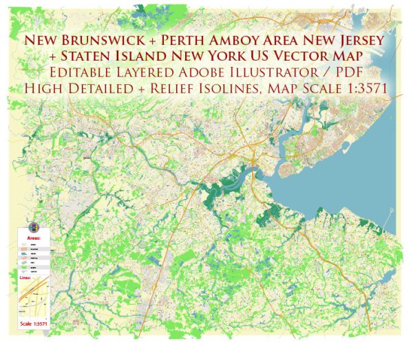
Some general information about New Brunswick, Perth Amboy, and Staten Island, including their principal waterways, bridges, and main streets. Vectormap.Net provide you with the most accurate and up-to-date vector maps in Adobe Illustrator, PDF and other formats, designed for editing and printing. Please read the vector map descriptions carefully.
New Brunswick, New Jersey:
Principal Waterways:
- Raritan River: Flows through the western part of New Brunswick.
Bridges:
- Albany Street Bridge: Connects New Brunswick with Highland Park over the Raritan River.
Main Streets:
- George Street: A major street running through downtown New Brunswick, known for its shops, restaurants, and cultural attractions.
- College Avenue: Home to Rutgers University’s College Avenue Campus and various student-oriented establishments.
Perth Amboy, New Jersey:
Principal Waterways:
- Arthur Kill: Forms part of the western boundary of Perth Amboy.
Bridges:
- Outerbridge Crossing: Although not directly in Perth Amboy, it connects Perth Amboy with Staten Island, New York, spanning the Arthur Kill.
Main Streets:
- Smith Street: A key thoroughfare in Perth Amboy with a mix of residential and commercial establishments.
- State Street: Another significant street with historical buildings and access to waterfront areas.
Staten Island, New York:
Principal Waterways:
- Upper New York Bay: Surrounds Staten Island to the east.
Bridges:
- Verrazzano-Narrows Bridge: Connects Staten Island with Brooklyn over the Narrows strait.
- Goethals Bridge: Connects Staten Island with Elizabeth, New Jersey.
Main Streets:
- Victory Boulevard: One of the longest and most significant streets on Staten Island, passing through various neighborhoods.
- Hylan Boulevard: Another major thoroughfare, stretching from the north to the south of the island.
Please note that developments and changes can occur, and it’s advisable to check more recent sources for the latest information on infrastructure and main streets in these areas.


 Author: Kirill Shrayber, Ph.D. FRGS