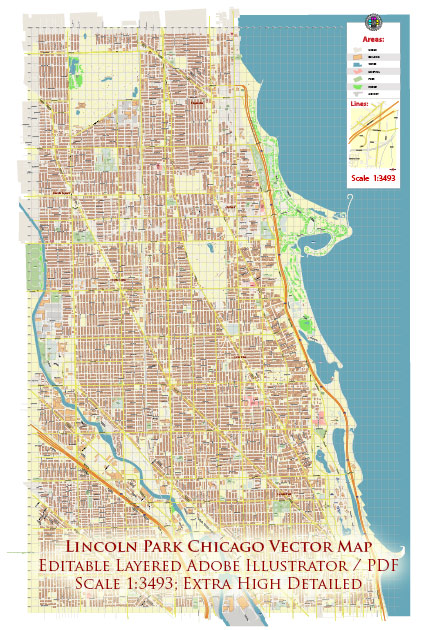
Lincoln Park is a vibrant neighborhood in Chicago, Illinois, known for its historic charm, tree-lined streets, and proximity to Lake Michigan. While it’s challenging to provide an exhaustive list of all the streets and roads in the area, I can highlight some principal streets and roads that are significant within Lincoln Park:
- Clark Street: One of the main commercial streets in Lincoln Park, Clark Street is lined with shops, restaurants, and cafes. It runs north-south and is a popular destination for shopping and dining.
- Halsted Street: Another major north-south thoroughfare, Halsted Street is known for its diverse range of businesses, including theaters, art galleries, and boutiques. The area around Halsted Street is also recognized for its LGBTQ+ community presence.
- Fullerton Avenue: Running east-west, Fullerton Avenue is a major thoroughfare that traverses Lincoln Park. It provides access to various residential areas, parks, and points of interest.
- Diversey Parkway: This east-west road is known for its beautiful tree-lined sections and connects various neighborhoods within Chicago, including Lincoln Park. It’s often used for commuting and as a route to access the lakefront.
- Armitage Avenue: Armitage is a popular street for shopping, featuring a mix of high-end boutiques and trendy stores. It runs east-west and intersects with both Halsted Street and Lincoln Avenue.
- Lincoln Avenue: As the name suggests, Lincoln Avenue is a central road in Lincoln Park. It runs parallel to the western edge of the neighborhood and is home to a mix of residential and commercial properties.
- Lake Shore Drive: While not within Lincoln Park itself, Lake Shore Drive is a major roadway that borders the eastern edge of the neighborhood. It offers stunning views of Lake Michigan and provides a scenic route for commuting.
- Webster Avenue: Another east-west thoroughfare, Webster Avenue runs through the southern part of Lincoln Park. It’s known for its residential character and proximity to DePaul University.
Keep in mind that Lincoln Park is a large and diverse neighborhood, and these are just a few of the principal streets and roads that contribute to its character. The area is well-connected by public transportation, including buses and the Chicago Transit Authority (CTA) train system, making it easy to explore the neighborhood and the rest of Chicago.


 Author: Kirill Shrayber, Ph.D. FRGS