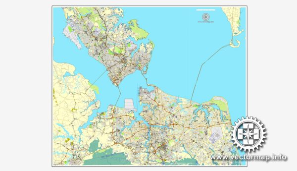
Hampton Roads is a metropolitan area located in the southeastern part of Virginia, USA. It encompasses several cities and communities, including Norfolk, Newport News, Chesapeake, Portsmouth, Hampton, Suffolk, and Virginia Beach. The region is known for its significant military presence, including the Norfolk Naval Base, which is the world’s largest naval base.
Waterways:
- Elizabeth River: This tidal estuary flows through the Hampton Roads region, dividing Norfolk from Portsmouth. It is a navigable waterway and has several bridges crossing it.
- James River: A major river that flows through the region, the James River is significant for its role in the history of Virginia and the United States. It has various ports and terminals along its course.
- Chesapeake Bay: While not directly within Hampton Roads, the Chesapeake Bay is nearby and influences the region’s climate and maritime activities. It is the largest estuary in the United States and provides essential habitat for numerous species.
Bridges and Tunnels:
- Hampton Roads Bridge-Tunnel (HRBT): Connects the cities of Hampton and Norfolk, spanning the Hampton Roads harbor. It includes a combination of bridges and tunnels to accommodate vehicular and marine traffic.
- Monitor-Merrimac Memorial Bridge-Tunnel (MMMBT): Connects Newport News and Suffolk, crossing the Monitor-Merrimac Harbor. It is named after the ironclad ships from the Civil War, the USS Monitor, and the CSS Virginia (Merrimac).
- James River Bridge: Spans the James River, connecting Newport News and Isle of Wight County. It is a vital transportation link for the region.
- Chesapeake Bay Bridge-Tunnel (CBBT): While not directly in Hampton Roads, it is nearby and connects Virginia Beach with the Eastern Shore of Virginia. It is a complex structure combining bridges, tunnels, and causeways.
These waterways and bridges play a crucial role in the transportation and connectivity of the Hampton Roads region, supporting both civilian and military activities. They are essential for commerce, tourism, and daily commuting in this populous and economically significant area.


 Author: Kirill Shrayber, Ph.D. FRGS