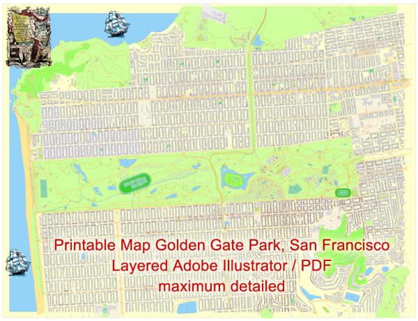
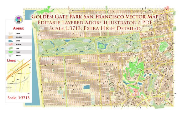
Golden Gate Park in San Francisco is a large urban park that spans over 1,000 acres. While it doesn’t have traditional streets and roads like a city grid, it does have several main pathways, roads, and attractions. Here are some key features and areas within Golden Gate Park:
- JFK Drive (John F. Kennedy Drive): This is one of the main roads that runs through the park from the eastern entrance at Stanyan Street to the western end near Ocean Beach. It’s a popular route for cyclists, joggers, and walkers.
- Great Highway: This road runs along the western edge of Golden Gate Park, separating the park from Ocean Beach. The Great Highway provides access to the beach and offers scenic views of the Pacific Ocean.
- Martin Luther King Jr. Drive: Parallel to JFK Drive, this road is located in the western part of the park and provides additional access to various attractions.
- Transverse Drives: There are several transverse roads (Transverse Drive, Middle Drive, and Overlook Drive) that connect JFK Drive and provide access to different sections of the park. They are named according to their location, dividing the park into the eastern, central, and western sections.
- Stanyan Street and 9th Avenue: These are major streets bordering the eastern side of Golden Gate Park. Stanyan Street provides an entrance to the park, and 9th Avenue is another important street running along the park’s eastern border.
- Conservatory of Flowers: Located on the eastern end of the park, this iconic structure is near the intersection of JFK Drive and Conservatory Drive East.
- California Academy of Sciences and de Young Museum: Situated in the central part of the park, near Music Concourse, these two prominent institutions are accessible from JFK Drive.
- Music Concourse: This is a central gathering area in Golden Gate Park, hosting the California Academy of Sciences and the de Young Museum. The Spreckels Temple of Music and the beautiful Pool of Enchantment are also located here.
- Shakespeare Garden: Found near Martin Luther King Jr. Drive and Bowling Green Drive, the Shakespeare Garden is a tranquil spot featuring flowers and plants mentioned in William Shakespeare’s plays.
- Botanical Garden: Located near 9th Avenue and Lincoln Way, the San Francisco Botanical Garden is a separate attraction within Golden Gate Park.
While Golden Gate Park doesn’t have a traditional street grid, its network of pathways and roads connects various attractions and natural areas, providing visitors with a diverse and expansive outdoor experience.


 Author: Kirill Shrayber, Ph.D. FRGS