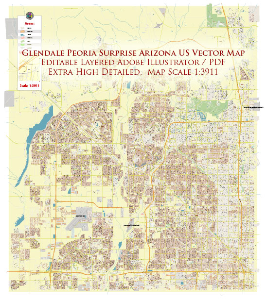
A general overview of the principal streets and roads in Glendale, Peoria, and Surprise, Arizona.
Glendale, Arizona:
- Grand Avenue (U.S. Route 60): Runs east-west through Glendale and is a major route connecting the city to Phoenix and other parts of the Valley.
- Loop 101 (Agua Fria Freeway): Forms a loop around the Phoenix metropolitan area, including Glendale. It provides access to various neighborhoods and commercial areas.
- 59th Avenue: A significant north-south road running through Glendale, providing access to residential areas, shopping centers, and schools.
- Bell Road: A major east-west road, particularly known for its commercial development, with numerous shopping centers and businesses along its route.
Peoria, Arizona:
- Grand Avenue (U.S. Route 60): Like in Glendale, Grand Avenue is a prominent road that runs through Peoria, connecting it to other parts of the Valley.
- Loop 101 (Agua Fria Freeway): The freeway loop is a key transportation route for Peoria, offering access to various neighborhoods and amenities.
- Peoria Avenue: An east-west road that spans Peoria, providing access to residential areas, parks, and commercial establishments.
- 83rd Avenue: A north-south road that intersects with major east-west roads like Bell Road, offering access to various parts of Peoria.
Surprise, Arizona:
- Bell Road: Extends into Surprise and is a major east-west road with various commercial developments, shopping centers, and residential areas.
- Loop 303: A critical freeway that connects Surprise to other parts of the Valley. It plays a significant role in the transportation infrastructure of the area.
- Waddell Road: Another east-west road that runs through Surprise, connecting residential neighborhoods and providing access to amenities.
- Surprise Parkway: A notable road that helps in navigating through Surprise, connecting different areas of the city.
Please keep in mind that urban planning and development can lead to changes in roadways and infrastructure. For the most up-to-date and detailed information, it’s recommended to check with local city planning departments or use navigation apps that provide real-time data.


 Author: Kirill Shrayber, Ph.D. FRGS