Finland, located in Northern Europe, has an extensive network of waterways and railroads that play a crucial role in its transportation infrastructure. Here’s a brief description of Finland’s principal waterways and railroads:
Waterways:
- Gulf of Bothnia:
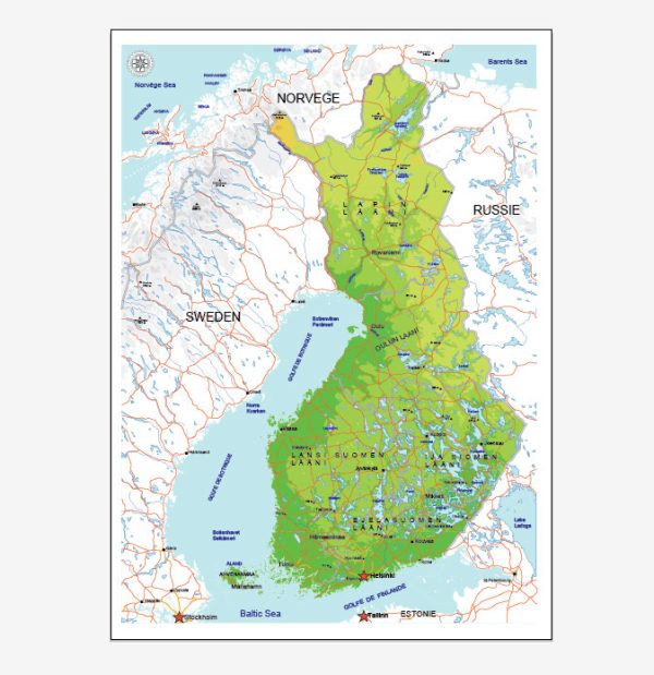
- The Gulf of Bothnia, situated to the west of Finland, is a significant water body that connects the country to the Baltic Sea. It serves as a crucial maritime route for shipping and transportation.
- Baltic Sea:
- Finland has an extensive coastline along the Baltic Sea, providing access to international shipping routes. The ports along the Baltic Sea are vital for trade and transportation.
- Saimaa Canal:
- The Saimaa Canal is a notable artificial waterway that connects Lake Saimaa in southeastern Finland to the Gulf of Finland. It facilitates navigation between the inland waterways and the Baltic Sea.
- Finnish Lakeland:
- Finland is often referred to as the “Land of a Thousand Lakes,” and its numerous lakes form an interconnected network of waterways. While these are primarily used for local transportation and recreation, they contribute to the overall water transport infrastructure.
Railroads:
- Finnish Rail Network:
- Finland has a well-developed and efficient rail network managed by the state-owned company VR Group. The rail system connects major cities and industrial centers, facilitating the movement of goods and passengers.
- Main Lines:
- The main railway lines in Finland include the Coastal Line (Rantarata), connecting Helsinki to Turku and other coastal cities, and the Main Line (Pääradan), connecting Helsinki to Tampere and beyond.
- Arctic Railway:
- There have been discussions and plans for the construction of the Arctic Railway, which would connect Rovaniemi in Finnish Lapland to the ice-free port of Kirkenes in Norway. This proposed railway aims to enhance transportation links in the northern regions.
- Helsinki Metro:
- Helsinki, the capital city, has a metro system that serves the Greater Helsinki area. It provides an efficient means of transportation within the city and its suburbs.
- High-Speed Rail Plans:
- Finland has considered the development of high-speed rail connections, particularly between Helsinki and other major cities, to further improve intercity transportation.
Both waterways and railroads are essential components of Finland’s transportation infrastructure, supporting domestic and international trade, as well as the movement of people within the country. They play a crucial role in the economic development and connectivity of the nation.


 Author: Kirill Shrayber, Ph.D. FRGS