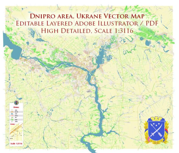
Dnipro, also spelled Dnieper, is a major city in Ukraine situated on the Dnieper River. The city is an important industrial, cultural, and scientific center in the country. Here’s an overview of the principal waterways and main roads in and around Dnipro:
Waterways:
- Dnieper River:
- The Dnieper River is the third longest river in Europe and one of the major waterways in Ukraine.
- Dnipro is located on the eastern bank of the Dnieper, making the river a prominent feature of the city.
- The river serves as a significant transportation route for both cargo and passengers.
- Dnipro River Port:
- Dnipro has a river port that facilitates the transportation of goods and passengers along the Dnieper River.
- The port plays a crucial role in the city’s economy and trade.
Main Roads:
- Avtomagistral/Motorways:
- The M04 and M18 are major motorways that connect Dnipro to other cities and regions.
- The M04 runs north to Kyiv and south to Zaporizhzhia.
- The M18 connects Dnipro to Donetsk in the east.
- H-08 (E50):
- The H-08 is a significant highway that passes through Dnipro and connects the city with other major Ukrainian cities.
- Zavodska Street:
- Zavodska Street is one of the main thoroughfares within the city.
- It is known for its industrial and commercial significance, hosting various businesses and factories.
- Naberezhna Peremohy (Embankment of Victory):
- This is a scenic road along the Dnieper River, providing beautiful views of the water and the city skyline.
- Sicheslavska Naberezhna:
- Another important road along the riverbank, offering recreational areas and access to various amenities.
- Central Bridge (Tsentralnyi Most):
- This bridge spans the Dnieper River and is a key transportation link connecting different parts of the city.
- Darnytska Square:
- This square serves as a central hub for traffic and transportation within the city.
- Aeroport (Airport) Highway:
- Connecting the city center to Dnipro International Airport, this road is crucial for air travel access.
These waterways and roads contribute to the connectivity and accessibility of Dnipro, supporting its economic activities, transportation networks, and overall development. Keep in mind that infrastructure details may change over time, so it’s advisable to check for the latest information if planning to travel or work in the area.


 Author: Kirill Shrayber, Ph.D. FRGS