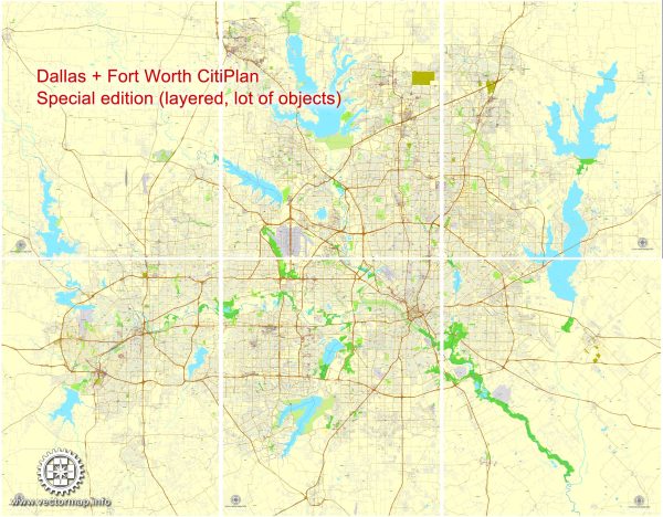
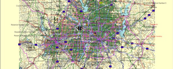
Dallas and Fort Worth, two major cities in Texas, are part of the Dallas-Fort Worth (DFW) metropolitan area, one of the largest and fastest-growing urban areas in the United States. The principal waterways and main roads in and around these cities play a crucial role in transportation and commerce.
Principal Waterways:
- Trinity River:
- The Trinity River is a significant waterway flowing through both Dallas and Fort Worth. It serves as a major source of water and contributes to the region’s natural beauty.
- White Rock Lake:
- Located in Dallas, White Rock Lake is a reservoir on the White Rock Creek. It provides recreational opportunities and is a popular spot for outdoor activities.
Main Roads and Highways:
- Interstate 35E (I-35E):
- This major interstate highway runs north-south, connecting Dallas and Fort Worth. It is a crucial transportation corridor for commuters and freight.
- Interstate 30 (I-30):
- Running east-west, I-30 connects downtown Dallas and downtown Fort Worth. It is a vital route for both local and interstate travel.
- Interstate 635 (I-635) – LBJ Freeway:
- Encircling much of Dallas, I-635 forms a loop and intersects with other major highways, facilitating travel within the metropolitan area.
- US Highway 75 (US-75):
- US-75 is a major north-south highway, connecting Dallas to cities in Texas and neighboring states.
- Texas State Highway 114 (TX-114):
- This east-west highway connects Dallas and Fort Worth, serving as a key route for commuters and cargo transport.
- Texas State Highway 183 (TX-183):
- Running parallel to I-30, TX-183 connects Dallas and Fort Worth, providing an alternative route for commuters.
- President George Bush Turnpike:
- This toll road forms a partial loop around Dallas and connects various highways, offering an additional route for motorists.
- Dallas North Tollway:
- Running from downtown Dallas to the northern suburbs, the Dallas North Tollway is a major toll road facilitating faster north-south travel.
- Fort Worth Mixmaster:
- A complex highway interchange where I-35W and I-30 meet in downtown Fort Worth, serving as a crucial transportation hub.
Understanding the layout of these waterways and road networks is essential for navigating the Dallas-Fort Worth metropolitan area efficiently. The region’s transportation infrastructure plays a key role in supporting economic activities and the daily lives of its residents.


 Author: Kirill Shrayber, Ph.D.