Illustrator Map Bethany Oklahoma US

Illustrator Map — Bethany Oklahoma US

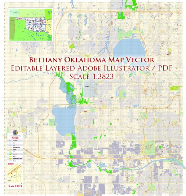
A clean Illustrator map of Bethany Oklahoma US with named layers and consistent geometry for fast cartographic work. Contours and landuse layers can be toggled to match tourism or planning use cases. Named layers let you restyle colors, line weights and label classes without cleanup passes. The file accepts custom grids, legends and callouts without redrawing base content. Typography spacing is tuned for quick reading on posters, brochures and reports. Coordinates and scales are prepared for sheet production and consistent exports.

Saves prepress time by reducing manual fixes and keeping the visual system consistent. Ideal for signage, event maps, campus leaflets and waterfront brochures. Files remain compact thanks to clean geometry and disciplined labeling. Editors can brand the palette and icons, then export sharp results for both print and web. Color systems can be swapped quickly to match seasonal or brand variants.

Principal streets and roads in Bethany, Oklahoma. A general understanding of how cities are typically organized in terms of streets and roads. In many cities, you’ll find a combination of major thoroughfares, arterial roads, collector streets, and local roads.

  1. Major Thoroughfares: These are often large roads designed to carry high volumes of traffic across the city or region. They may include highways and major avenues.
  2. Arterial Roads: These are roads that connect major thoroughfares with collector streets. They typically handle a significant amount of traffic but are smaller than major thoroughfares.
  3. Collector Streets: These roads collect traffic from local streets and connect them to arterial roads. They help distribute traffic within neighborhoods.
  4. Local Roads: These are the streets within neighborhoods and residential areas. They primarily serve local traffic and provide access to individual properties.

To get detailed information about specific streets and roads in Bethany, you can visit the official website of the city, contact the city’s Department of Public Works or Transportation, or check with local maps and navigation services. Additionally, you may find community resources or local publications that highlight important roads and landmarks in Bethany.

Author: Kirill Shrayber, Ph.D.

I have been working with vector cartography for over 25 years, including GPS, GIS, Adobe Illustrator and other professional cartographic software.
Linkedin: https://www.linkedin.com/in/kirill-shrayber-0b839325/
Twitter: https://twitter.com/vectormapper

Are we missing some maps? Let us know!!!
What map do you need?

    We will upload it within the next 24 hours and notify you by Email.

    Menu