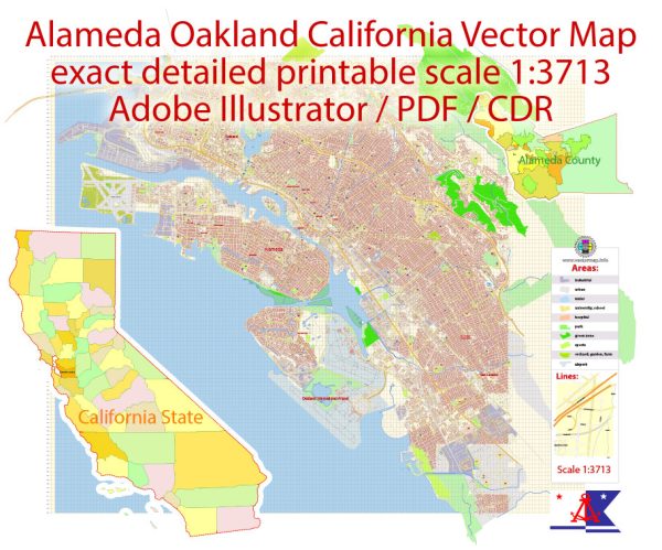
Introduction to Alameda, California
The city of Alameda is situated in Alameda County, California, and is adjacent to
the city of Oakland (less than 5 miles to the north). The name of the city was chosen
by a popular vote conducted in 1853, and is Spanish for “grove of poplar trees”.
In 1916 Alameda became a “charter city”, meaning that it is governed in accordance
with its own city charter, as opposed to a “general law” city, which is governed
principally by the laws of the state of California.
Alameda became an important shipping port in 1902 when excavation was done to create a
tidal canal joining San Leandro Bay with the harbor of Oakland. World War II saw
the establishment of the Naval Air Station Alameda, a sizable naval facility containing
a large airfield and docks capable of accommodating several aircraft carriers.
Although the Air Station closed in 1997, a massive hangar located there has in
recent years been used to film special Computer-Generated Imagery scenes for several
movies, including Bicentennial Man, Flubber, and Mission: Impossible II.
Things to do in the Alameda area
Alameda’s proximity to the Bay affords spectators many beautiful views of
the San Francisco-Oakland Bay Bridge and the San Francisco skyline.
One of the more recent Alameda attractions is the aircraft carrier USS Hornet,
now moored at the former Naval Air Station. The Hornet was used in World War II to
launch a squadron of B-25s in the Tokyo raid conducted by General James Doolittle, an Alameda native.
Other Alameda attractions include: the Alameda Civic Light Opera, featuring Broadway-style musical productions;
“Art In the Park”, an annual event held in late summer which features art, poetry, music, and food;
“Shining Stars In The Arts”, held in May and honoring Alameda community members who have contributed to the city’s art.
Many popular attractions can be found in nearby Oakland. These include: the Oakland Zoo,
the Oakland California Temple, Preservation Park, Chabot Space and Science Center,
the Christensen Heller Gallery, and the Alice Arts Center.
The city of San Francisco is a short 16-mile drive northwest on Interstate 880
and then west on I-80 across the Bay Bridge. Attractions abound in this city,
including (to name just a few):
Golden Gate Park
Fisherman’s Wharf
Japanese Tea Garden
San Francisco Zoo
Alcatraz
Chinatown
Cable Car Museum
Demographics
People
Total Population 78,462
Male Share of the Population 48.4%
Female Share of the Population 51.6%
Senior Citizens 15%
Employed Population 16+ 40,715
Age of the Population 41


 Author: Kirill Shrayber, Ph.D. FRGS