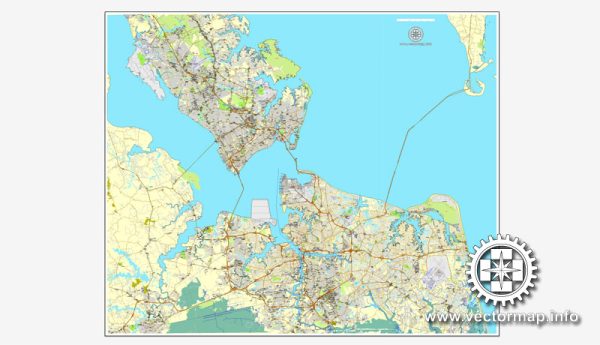
Hampton Roads is a metropolitan area in the southeastern part of Virginia, United States, encompassing several cities and counties, with Norfolk and Newport News being two significant cities in the region. The principal roads and railroads in the Hampton Roads area play a crucial role in facilitating transportation and connectivity. Here is a general description of some of the major roads and railroads in the Hampton Roads area:
Principal Roads:
- Interstate 64 (I-64): This major east-west interstate highway connects the Hampton Roads area with Richmond to the west and the Hampton Roads Bridge-Tunnel to the east.
- Interstate 264 (I-264): Running primarily east-west, I-264 connects Portsmouth, Norfolk, and Virginia Beach. It serves as a vital route for local and regional traffic.
- Interstate 464 (I-464): This interstate highway connects the city of Chesapeake to the harbor area of Norfolk, providing a direct route between the two.
- U.S. Route 13 (US-13): Running north-south, US-13 is a major highway that passes through Norfolk, Portsmouth, and Chesapeake, providing connectivity within the region.
- U.S. Route 17 (US-17): This north-south highway runs through the Hampton Roads area, connecting the region with points north and south.
- U.S. Route 58 (US-58): An east-west route that connects the Hampton Roads area with points in southwestern Virginia.
- Virginia State Route 164 (VA-164): This state highway provides a connection between Portsmouth and Suffolk, helping to improve regional accessibility.
Railroads:
- Norfolk Southern Railway: Norfolk Southern operates railroads in the Hampton Roads region, providing freight transportation services. The Port of Virginia is a key location for rail connections, facilitating the movement of goods to and from the port.
- CSX Transportation: CSX also operates rail lines in the area, contributing to the efficient transportation of goods and materials. The rail network plays a vital role in supporting the region’s economic activities, especially related to the port and industrial facilities.
For the most current and detailed information, it’s recommended to check with local transportation authorities, such as the Virginia Department of Transportation (VDOT) and relevant city planning departments.


 Author: Kirill Shrayber, Ph.D. FRGS