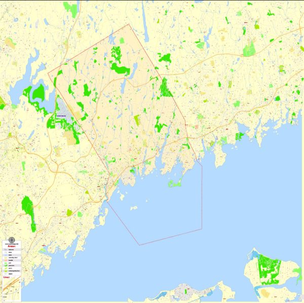
Greenwich, Connecticut, located in Fairfield County, is a town that is well-connected by various modes of transportation. Here’s a brief description of the principal transportation systems in Greenwich:
- Roads and Highways:
- Interstate 95 (I-95): Greenwich is traversed by Interstate 95, a major north-south highway along the East Coast of the United States. I-95 provides a crucial transportation route for commuters and facilitates easy access to neighboring towns and cities.
- Merritt Parkway (Route 15): This scenic parkway also passes through Greenwich, offering an alternative route for commuters. It is known for its tree-lined lanes and is designated as a National Scenic Byway.
- Metro-North Railroad:
- The Metro-North Railroad’s New Haven Line serves Greenwich, providing direct rail service to New York City. The Greenwich train station is a key transportation hub, making it convenient for residents to commute to Manhattan and other parts of Connecticut.
- Bus Services:
- The Connecticut Department of Transportation operates local and regional bus services in Greenwich. These buses connect residents to neighboring towns and cities, providing an additional mode of public transportation.
- Taxis and Ridesharing:
- Taxis and ridesharing services, such as Uber and Lyft, are readily available in Greenwich. They offer convenient transportation options for residents and visitors, especially for shorter distances within the town.
- Airports:
- Although there is no airport within Greenwich itself, the town is within a reasonable distance of several major airports. The closest major airport is Westchester County Airport (HPN) in New York, providing domestic flights. Additionally, airports like LaGuardia Airport (LGA) and John F. Kennedy International Airport (JFK) in New York are accessible for international and domestic travel.
- Cycling and Walking:
- Greenwich is known for its pedestrian-friendly areas and scenic landscapes. Many residents choose to walk or cycle for short distances, and the town has implemented measures to enhance pedestrian and cyclist safety.
- Waterways:
- Greenwich has a coastline along Long Island Sound, but there isn’t a significant reliance on water transportation for daily commuting. However, recreational boating and access to Long Island Sound contribute to the town’s overall transportation options.
Overall, Greenwich’s principal transportation systems are well-developed, providing residents with various options for commuting locally and accessing nearby urban centers like New York City. The combination of highways, rail services, buses, and other transportation modes contributes to the town’s accessibility and connectivity.


 Author: Kirill Shrayber, Ph.D. FRGS