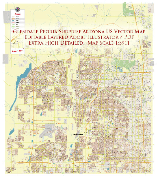
A general overview of the transportation systems in Glendale, Peoria, and Surprise, Arizona. Please note that specific details may have changed, and it’s recommended to check with local authorities or recent sources for the latest information.
Glendale, Arizona:
- Roads and Highways:
- Glendale is well-connected by a network of roads and highways, including the US 60, Loop 101, and Loop 303.
- Grand Avenue (US 60) runs through Glendale, providing a major east-west route.
- Public Transportation:
- The city is served by the Valley Metro bus system, providing public transportation services within the metropolitan area.
- Airports:
- Glendale is close to the Phoenix Sky Harbor International Airport, one of the major airports in the region.
Peoria, Arizona:
- Roads and Highways:
- Peoria is accessible via Loop 101 and Loop 303, providing convenient travel within the Phoenix metropolitan area.
- Grand Avenue (US 60) also passes through parts of Peoria.
- Public Transportation:
- Similar to Glendale, Peoria is served by the Valley Metro bus system.
- Airports:
- Peoria is in proximity to Phoenix Sky Harbor International Airport.
Surprise, Arizona:
- Roads and Highways:
- Surprise is connected to major highways such as US 60 (Grand Avenue), Loop 303, and US 303.
- Public Transportation:
- The city is served by Valley Metro’s bus services, connecting residents to other parts of the Phoenix metropolitan area.
- Airports:
- Like Glendale and Peoria, Surprise benefits from its proximity to Phoenix Sky Harbor International Airport.
Regional Collaboration:
- Valley Metro:
- All three cities are part of the Valley Metro regional public transportation system, which aims to provide an integrated and efficient transit network for the Phoenix metropolitan area.
- Transportation Planning:
- The Maricopa Association of Governments (MAG) plays a role in regional transportation planning, coordinating efforts to address transportation needs in the broader metropolitan area.
It’s important to check for any updates or changes in transportation infrastructure and services, as well as ongoing and future development projects that may impact transportation in these cities. Local transportation authorities and city websites are good resources for the most current information.


 Author: Kirill Shrayber, Ph.D. FRGS